IMAGES TAKEN NEAR TO
Lea End Lane, BIRMINGHAM, B48 7AY
Introduction
This page details the photographs taken nearby to Lea End Lane, B48 7AY by members of the Geograph project.
The Geograph project started in 2005 with the aim of publishing, organising and preserving representative images for every square kilometre of Great Britain, Ireland and the Isle of Man.

There are currently over 7.5m images from over14,400 individuals and you can help contribute to the project by visiting https://www.geograph.org.uk
Image Map (Loading...)


Getting Data...Please wait
Leaflet Map data © OpenStreetMap
Images are licensed for reuse under creativecommons.org/licenses/by-sa/2.0
Notes
- Clicking on the map will re-center to the selected point.
- The higher the marker number, the further away the image location is from the centre of the postcode.
Image Listing (15 Images Found)
Images are licensed for reuse under creativecommons.org/licenses/by-sa/2.0
Image
Details
Distance
1

Lea End Farm, Lea End, catches the sun
The house is in a bit of a hollow. From an aerial photo it's clear that this is no longer a working farm but is all residential – at least eight dwellings. The nearest working farm is Broadcroft Farm Image in SP0474.
Image: © Robin Stott
Taken: 25 Oct 2013
0.02 miles
2
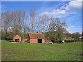
Farm buildings at Lea End
Still apparently in use for farming purposes.
Image: © David Stowell
Taken: 14 Apr 2006
0.02 miles
3

Lea End Farm from up Lea End Lane
The viewpoint was beneath an oak tree by a field gate. The ground was covered in acorns that crackled or rolled around beneath one's feet.
Image: © Robin Stott
Taken: 25 Oct 2013
0.02 miles

5

Pasture at Lea End Farm
View north-west from Lea End Lane.
Image: © Jonathan Billinger
Taken: 30 Jul 2013
0.10 miles


8

View over Lea End
Looking across the square with the houses and farm at Lea End in the foreground and in the distance in adjoining square, the houses in Hopwood on the Redditch Road.
Image: © David Stowell
Taken: 14 Apr 2006
0.19 miles
9

Broadcroft Farm
The farmhouse (a listed building) is boarded up and the farmyard appears disused. There has been at least one planning application to convert the farm buildings to residential units.
Image: © Paul Collins
Taken: 29 Nov 2020
0.20 miles
10

Broadcroft Farm
The farmhouse (a listed building) is boarded up and the farmyard appears disused. There has been at least one planning application to convert the farm buildings to residential units.
Image: © Paul Collins
Taken: 29 Nov 2020
0.20 miles