IMAGES TAKEN NEAR TO
Birmingham Road, BIRMINGHAM, B48 7AJ
Introduction
This page details the photographs taken nearby to Birmingham Road, B48 7AJ by members of the Geograph project.
The Geograph project started in 2005 with the aim of publishing, organising and preserving representative images for every square kilometre of Great Britain, Ireland and the Isle of Man.

There are currently over 7.5m images from over14,400 individuals and you can help contribute to the project by visiting https://www.geograph.org.uk
Image Map
Images are licensed for reuse under creativecommons.org/licenses/by-sa/2.0
Notes
- Clicking on the map will re-center to the selected point.
- The higher the marker number, the further away the image location is from the centre of the postcode.
Image Listing (11 Images Found)
Images are licensed for reuse under creativecommons.org/licenses/by-sa/2.0
Image
Details
Distance
2
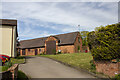
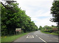
Hopwood Village Hall
Beside the main Birmingham - Redditch Road as it passes through the village.
Image: © David Stowell
Taken: 14 Apr 2006
0.04 miles
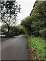
3
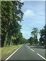
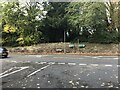
A441 Birmingham Road
Looking north past the Westmead Hotel, Hopwood.
Image: © Jonathan Billinger
Taken: 30 Jul 2013
0.04 miles
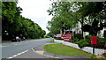
5
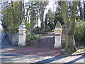
Hopwood Grange
The gates to the Grange from the Alvechurch Road.
Image: © David Stowell
Taken: 14 Apr 2006
0.06 miles
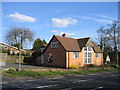
9
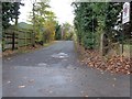
Drive to Hopwood Court, Retirement Home
Image: © Jeff Gogarty
Taken: 14 Nov 2016
0.20 miles