
IMAGES TAKEN NEAR TO
St. Chads Queensway, BIRMINGHAM, B4 6ET
Introduction
This page details the photographs taken nearby to St. Chads Queensway, B4 6ET by members of the Geograph project.
The Geograph project started in 2005 with the aim of publishing, organising and preserving representative images for every square kilometre of Great Britain, Ireland and the Isle of Man.

There are currently over 7.5m images from over14,400 individuals and you can help contribute to the project by visiting https://www.geograph.org.uk
Image Map
Images are licensed for reuse under creativecommons.org/licenses/by-sa/2.0
Notes
- Clicking on the map will re-center to the selected point.
- The higher the marker number, the further away the image location is from the centre of the postcode.
Image Listing (636 Images Found)
Images are licensed for reuse under creativecommons.org/licenses/by-sa/2.0
Image
Details
Distance
2
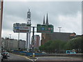
A38 Queensway, View of St. Chads and BT Tower
Image: © Roy Hughes
Taken: 6 May 2009
0.02 miles
3
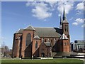
St Chads Cathedral
The Roman Catholic cathedral in the city.
Image: © John M
Taken: 8 Apr 2010
0.03 miles
4
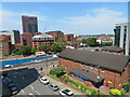
St Chad's Queensway, Birmingham
From the top of a multi-storey car park in Whittall Street, which is the street at the bottom of the image.
Image: © Chris Allen
Taken: 24 May 2023
0.03 miles
5
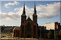
St Chads
St Chads is the Roman Catholic Cathedral in the centre of Birmingham.
Image: © Derek Bennett
Taken: 5 Oct 2008
0.03 miles
7
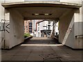
The Gunmakers' Arms, Bath Street
This historic Birmingham pub in the Gunsmiths' Quarter is viewed from the pedestrian underpass under St Chad's Queensway. The Gunmakers' Arms is a listed building, dating from around 1820 according to the listing at the Historic England site, with a mid-19th century pub front https://historicengland.org.uk/listing/the-list/list-entry/1219930?section=official-list-entry . It adjoins a former gun factory.
Image: © A J Paxton
Taken: 2 Apr 2022
0.03 miles
8
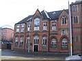
Archbishop's House - Shadwell Street
The Archbishop's House occupies a former Primary School behind St Chad's RC Cathedral. The original Pugin-designed Bishop's House was demolished in 1959 to allow construction of the Inner Ring Road.
Image: © John M
Taken: 19 Nov 2010
0.04 miles
9
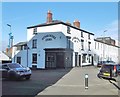
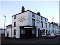
Birmingham, Gunmakers Arms
Good Beer Guide listed pub on Bath Street; closed at my visit. No doubt, named after its location in the Gun Quarter.
Image: © Mike Faherty
Taken: 3 Feb 2019
0.04 miles
10
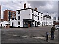
Bath Street with the Gunmakers' Arms
This is a well-preserved block of the Gunsmiths' Quarter of Birmingham. The Gunmakers' Arms pub dates from around 1820, with a mid-19th century pub front, according to its listing at Historic England. It appears to be three houses knocked together. https://historicengland.org.uk/listing/the-list/list-entry/1219930?section=official-list-entry .
Wrapped around it on Bath Street, to the right, Little Shadwell Street, to the left, and Shadwell Street, behind, are a group of 19th century industrial buildings. According to the Historic England listing, the Bath Street range, to the right of the pub, was built in 1839-40 for a coachmaker, William Read. It was later extended around most of the block and by 1860 it was occupied by Thomas Mabbutt, a gun implement maker. Since then it has been used at various times for making guns, bicycles and other light engineering products https://historicengland.org.uk/listing/the-list/list-entry/1034381?section=official-list-entry .
Image: © A J Paxton
Taken: 2 Apr 2022
0.04 miles