IMAGES TAKEN NEAR TO
Station Road, BIRMINGHAM, B46 1EE
Introduction
This page details the photographs taken nearby to Station Road, B46 1EE by members of the Geograph project.
The Geograph project started in 2005 with the aim of publishing, organising and preserving representative images for every square kilometre of Great Britain, Ireland and the Isle of Man.

There are currently over 7.5m images from over14,400 individuals and you can help contribute to the project by visiting https://www.geograph.org.uk
Image Map
Images are licensed for reuse under creativecommons.org/licenses/by-sa/2.0
Notes
- Clicking on the map will re-center to the selected point.
- The higher the marker number, the further away the image location is from the centre of the postcode.
Image Listing (24 Images Found)
Images are licensed for reuse under creativecommons.org/licenses/by-sa/2.0
Image
Details
Distance
1
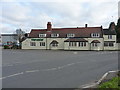
Coleshill Harvester bar & grill
Originally this was the Wheatsheaf pub, but little or no signage remains on the outside. Maybe some dues are paid to the old name in the bar? It was lunchtime, but I didn't have time for a visit.
Image: © Richard Law
Taken: 24 Nov 2016
0.00 miles
2
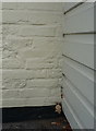
OS benchmark - Cole End, the former Wheatsheaf
An OS cutmark on the south gable end of the building that is currently Image It was originally levelled in 1957 at 74.889m above Ordnance Datum Newlyn.
Image: © Richard Law
Taken: 24 Nov 2016
0.01 miles
3

The Harvester Pub and Grill
The Harvester is located by the river Cole just before you enter Cole End
Image: © John A Lainchbury
Taken: 23 Apr 2009
0.03 miles
6
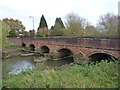
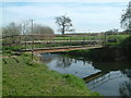
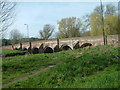
Cole Bridge at Cole End
Originally a mid-16th Century bridge, but extensively altered and repaired in more recent times. The structure was given Grade II* listed status after surveying in the early 1960s, and is detailed at http://www.britishlistedbuildings.co.uk/en-309332-cole-bridge-coleshill-warwickshire#.WDn7cNSLTGg
Image: © Richard Law
Taken: 24 Nov 2016
0.05 miles
7
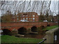
Cole End Bridge
Looking at the single lane road bridge over the River Cole at Cole End near Coleshill.
Image: © Simon Dean
Taken: 7 Jan 2005
0.06 miles
8
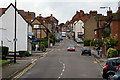
Coleshill High Street looking to the south
Coleshill High Street taken from the lower end of the town just by the river Cole.
Image: © John A Lainchbury
Taken: 8 Jun 2009
0.08 miles
9
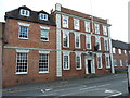
1 High Street, Coleshill
Grade II listed https://britishlistedbuildings.co.uk/101299644-1-high-street-coleshill#.W93f_tSLTGg in 1952, this early 18th century main (3-storey) portion of the house, and the mid 19th century 2-storey extension to the left are the main parts of the building. They link into an earlier, 17th century, brick-built part which lies offshot to the left.
Image: © Richard Law
Taken: 29 Oct 2018
0.10 miles