
IMAGES TAKEN NEAR TO
St. Pauls Crescent, BIRMINGHAM, B46 1BB
Introduction
This page details the photographs taken nearby to St. Pauls Crescent, B46 1BB by members of the Geograph project.
The Geograph project started in 2005 with the aim of publishing, organising and preserving representative images for every square kilometre of Great Britain, Ireland and the Isle of Man.

There are currently over 7.5m images from over14,400 individuals and you can help contribute to the project by visiting https://www.geograph.org.uk
Image Map
Images are licensed for reuse under creativecommons.org/licenses/by-sa/2.0
Notes
- Clicking on the map will re-center to the selected point.
- The higher the marker number, the further away the image location is from the centre of the postcode.
Image Listing (101 Images Found)
Images are licensed for reuse under creativecommons.org/licenses/by-sa/2.0
Image
Details
Distance
1
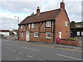
37 High Street, Coleshill
A Grade II listed, 16th Century building on the High Street. The building's features, some of which are visible in this photo, are described at http://www.britishlistedbuildings.co.uk/en-309334-37-high-street-coleshill-warwickshire#.WDdiMtSLTGg
Image: © Richard Law
Taken: 24 Nov 2016
0.05 miles
2
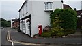
Pillar Box and Old House on High Street
This old house looks as though it used to be a commercial building.
Image: © Paul Collins
Taken: 9 Jun 2018
0.06 miles
3

St Andrews house, Coleshill
A large early-to-mid 19th century town house (now part of the council's Social Services provision for children) which was Grade II listed https://britishlistedbuildings.co.uk/101034693-st-andrews-coleshill#.XY-mREZKjcs & https://historicengland.org.uk/listing/the-list/list-entry/1034693 in 1989.
Image: © Richard Law
Taken: 1 Aug 2019
0.06 miles
4
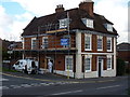
Laburnam House, Coleshill
Situated on the corner of Old Penns Lane with the High Street, Laburnam House was built in the 18th century (the windows are more recent) and was Grade II listed https://britishlistedbuildings.co.uk/101365207-laburnam-house-coleshill#.W93eRdSLTGg in 1952.
Image: © Richard Law
Taken: 29 Oct 2018
0.07 miles

6
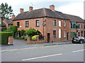
The Arches, Coleshill
An early 19th century town house, which looks quite a lot more modern than it actually is, and was Grade II listed https://britishlistedbuildings.co.uk/101034665-the-arches-coleshill#.XY-nrEZKjcs & https://historicengland.org.uk/listing/the-list/list-entry/1034665 in 1977.
Image: © Richard Law
Taken: 1 Aug 2019
0.08 miles


9
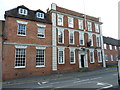
1 High Street, Coleshill
Grade II listed https://britishlistedbuildings.co.uk/101299644-1-high-street-coleshill#.W93f_tSLTGg in 1952, this early 18th century main (3-storey) portion of the house, and the mid 19th century 2-storey extension to the left are the main parts of the building. They link into an earlier, 17th century, brick-built part which lies offshot to the left.
Image: © Richard Law
Taken: 29 Oct 2018
0.10 miles
10
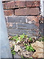
OS benchmark - Coleshill, 70 High Street
An OS cutmark low on the front wall of no 70 High Street; originally levelled in 1957 at 93.555m above Ordnance Datum Newlyn.
Image: © Richard Law
Taken: 24 Nov 2016
0.11 miles