
IMAGES TAKEN NEAR TO
Regina Avenue, BIRMINGHAM, B44 8TH
Introduction
This page details the photographs taken nearby to Regina Avenue, B44 8TH by members of the Geograph project.
The Geograph project started in 2005 with the aim of publishing, organising and preserving representative images for every square kilometre of Great Britain, Ireland and the Isle of Man.

There are currently over 7.5m images from over14,400 individuals and you can help contribute to the project by visiting https://www.geograph.org.uk
Image Map
Images are licensed for reuse under creativecommons.org/licenses/by-sa/2.0
Notes
- Clicking on the map will re-center to the selected point.
- The higher the marker number, the further away the image location is from the centre of the postcode.
Image Listing (4 Images Found)
Images are licensed for reuse under creativecommons.org/licenses/by-sa/2.0
Image
Details
Distance
1
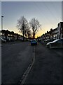
Birkenshaw Road
A cold afternoon with the sun setting. New Year 2025.
Image: © Tim Bartlett
Taken: 2 Jan 2025
0.21 miles
2
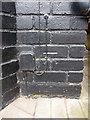
OS benchmark - Perry Beeches, 813 Aldridge Road
An OS cutmark on the front wall of no 813 Aldridge Road; it was originally levelled, probably in 1962, at 128.897m above Ordnance Datum Newlyn.
Image: © Richard Law
Taken: 8 Mar 2018
0.21 miles
3
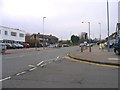
Aldridge Road from Dyas Road
Road junction.
Image: © Roy Hughes
Taken: 29 Jan 2009
0.22 miles
4

Yew Tree Cottages, Oscott
Described in their Grade II listing https://www.britishlistedbuildings.co.uk/101343372-yew-tree-cottages-oscott-ward#.WqeDiPnFKM8 as "probably late 17th century in origin, altered in the 19th as tenements". They are a remarkable survivor in the middle of the city of a much earlier time and were only recognised and listed in 1982.
Image: © Richard Law
Taken: 8 Mar 2018
0.25 miles