
IMAGES TAKEN NEAR TO
Queslett Road East, BIRMINGHAM, B43 7EE
Introduction
This page details the photographs taken nearby to Queslett Road East, B43 7EE by members of the Geograph project.
The Geograph project started in 2005 with the aim of publishing, organising and preserving representative images for every square kilometre of Great Britain, Ireland and the Isle of Man.

There are currently over 7.5m images from over14,400 individuals and you can help contribute to the project by visiting https://www.geograph.org.uk
Image Map
Images are licensed for reuse under creativecommons.org/licenses/by-sa/2.0
Notes
- Clicking on the map will re-center to the selected point.
- The higher the marker number, the further away the image location is from the centre of the postcode.
Image Listing (12 Images Found)
Images are licensed for reuse under creativecommons.org/licenses/by-sa/2.0
Image
Details
Distance
1
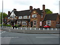
The Deers Leap
A pub on the Queslett Road; if my schoolboy grammar is to be trusted, there should be a possessive apostrophe in the name of this place - Deer's would be correct.
Image: © Richard Law
Taken: 12 Jun 2013
0.02 miles
2
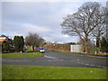
East end of Doe Bank Lane, Pheasey
Doe Bank Lane marks the edge of Pheasey estate, and of the contiguous built up area of the West Midlands. There is only housing development on the south west (left) side of the road, with farmland along the other side. The road on the left is Stanhope Way, while Queslett Road East, marking the boundary between Walsall borough and the city of Birmingham, is behind the photographer.
Image: © Richard Vince
Taken: 31 Jan 2015
0.06 miles
3
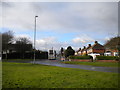
East end of Stanhope Way, Pheasey
Seen from a small grassed area that separates Stanhope Way from Queslett Road East, on the very edge of Pheasey estate (and Walsall borough). Shortworkings on bus service 997, a limited stop service from Birmingham city centre via Old Oscott, terminate here; one bus has just arrived, another leaving at the same time. Through journeys from Walsall cannot access Stanhope Way as there is no gap in the central reservation of Queslett Road East to permit a right turn. The road off Stanhope Way to the left is a service road for Queslett Road East.
Image: © Richard Vince
Taken: 31 Jan 2015
0.07 miles
4
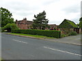
Doe Bank Farm
The buildings of the farm are rather hidden by roadside trees on Doe Bank Lane.
Image: © Richard Law
Taken: 12 Jun 2013
0.12 miles
5
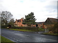
Doe Bank Farm near Pheasey
On the opposite side of Doe Bank Lane, behind the photographer, is the edge of Pheasey housing estate.
Image: © Richard Vince
Taken: 31 Jan 2015
0.13 miles
6
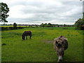
Two donkeys at Doe Bank Farm
One was quite inquisitive about the strange man with a camera; the other, quite clearly, couldn't give tuppence for me.
Image: © Richard Law
Taken: 12 Jun 2013
0.16 miles
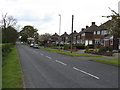
8
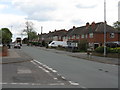
Pheasey - Stanhope Way
Tuesday was bin day!
Image: © Peter Whatley
Taken: 11 May 2010
0.19 miles
9
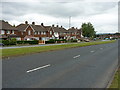
Houses on the south side of Queslett Road
Actually not all that different to the Image, but a little further along towards Sutton Park.
Image: © Richard Law
Taken: 12 Jun 2013
0.19 miles
10
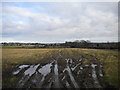
Field north of Doe Bank Farm near Pheasey
Looking across the mud from the edge of Pheasey estate towards Hundred Acre estate.
Image: © Richard Vince
Taken: 31 Jan 2015
0.20 miles