
IMAGES TAKEN NEAR TO
Old Walsall Road, BIRMINGHAM, B42 1EA
Introduction
This page details the photographs taken nearby to Old Walsall Road, B42 1EA by members of the Geograph project.
The Geograph project started in 2005 with the aim of publishing, organising and preserving representative images for every square kilometre of Great Britain, Ireland and the Isle of Man.

There are currently over 7.5m images from over14,400 individuals and you can help contribute to the project by visiting https://www.geograph.org.uk
Image Map
Images are licensed for reuse under creativecommons.org/licenses/by-sa/2.0
Notes
- Clicking on the map will re-center to the selected point.
- The higher the marker number, the further away the image location is from the centre of the postcode.
Image Listing (23 Images Found)
Images are licensed for reuse under creativecommons.org/licenses/by-sa/2.0
Image
Details
Distance
1

Hamstead Hill Towards Railway Station With Shell Garage
Image: © Roy Hughes
Taken: 12 May 2009
0.01 miles
2
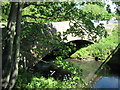
Stone Bridge Over River Tame, Hamstead Hill.
Image: © Roy Hughes
Taken: 12 May 2009
0.04 miles
3

The old Tame bridge
A Grade II listed structure at the north end of hamstead Hill; the bridge originally dates from the late 18th Century, but saw repairs and alterations in the 19th and 20th. It is now bypassed by a modern road bridge a few yards to the east.
Image: © Richard Law
Taken: 8 Mar 2017
0.04 miles
4
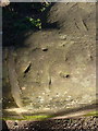
Remains of OS pivot mark
On a coping stone of Image, this rather weathered mark and round hole appear to be the remains of an OS pivot benchmark. It doesn't feature on the OS database now, but older maps show a levelled height (albeit on the other parapet of the bridge) at 336' 11" above sea level.
Image: © Richard Law
Taken: 8 Mar 2017
0.05 miles
5
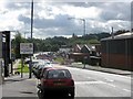
Welcome to Birmingham
Somewhat south of the actual city boundary, if the OS map is to be believed. The B4124 will magically transform from Old Walsall Road to Hamstead Hill a little further on.
Image: © Peter Whatley
Taken: 29 Sep 2008
0.05 miles
6
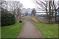
The old Tame Bridge at Hamstead
Go back a couple of hundred years and this was the main route between Birmingham and Walsall.
Image: © Adrian Bailey
Taken: 20 Mar 2005
0.09 miles
7
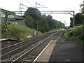
Grand Junction Railway east of Hamstead station
The original Crewe-Birmingham railway line avoided Wolverhampton and approached Birmingham along the more easily accessed land of the Tame Valley. The line has renewed importance in the 21st century due to saturation of the later direct route via Tipton and Smethwick.
Image: © Peter Whatley
Taken: 29 Sep 2008
0.10 miles
8
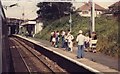
Hamstead Station, 80s style
Compare this photo (taken in early 80s) to Image Buildings have not changed much, parking was virtually impossible on streets above, but still a very steady stream of passengers. Photo taken pre-Tame Bridge station and pre-extension of route beyond Walsall to Cannock and Rugeley.
In these days, windows could be opened to take photos from - mind your head !
Image: © Michael Westley
Taken: Unknown
0.12 miles
9
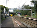
Hamstead station
A train from Birmingham to Walsall is leaving.
Image: © Peter Whatley
Taken: 29 Sep 2008
0.12 miles
10
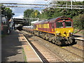
Freight through Hamstead
A train of coiled steel wire heads south-east through the station, hard on the heels of a local passenger train.
Image: © Peter Whatley
Taken: 29 Sep 2008
0.12 miles