IMAGES TAKEN NEAR TO
Redhill Road, BIRMINGHAM, B38 9EN
Introduction
This page details the photographs taken nearby to Redhill Road, B38 9EN by members of the Geograph project.
The Geograph project started in 2005 with the aim of publishing, organising and preserving representative images for every square kilometre of Great Britain, Ireland and the Isle of Man.

There are currently over 7.5m images from over14,400 individuals and you can help contribute to the project by visiting https://www.geograph.org.uk
Image Map
Images are licensed for reuse under creativecommons.org/licenses/by-sa/2.0
Notes
- Clicking on the map will re-center to the selected point.
- The higher the marker number, the further away the image location is from the centre of the postcode.
Image Listing (12 Images Found)
Images are licensed for reuse under creativecommons.org/licenses/by-sa/2.0
Image
Details
Distance
1
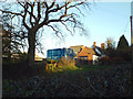
Redhill Farm, Redhill
A public footpath heads north past the farm to Goodrest Farm, Goodrest Lane. The farm stands opposite Redhill Lodge.
Image: © Robin Stott
Taken: 30 Nov 2013
0.09 miles
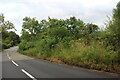
2
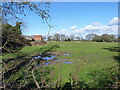
A field by Redhill Farm
Several of the photos in this square show wet fields in the area; there must be something about the soil makeup that leads to a lack of drainage.
Image: © Richard Law
Taken: 26 Feb 2020
0.12 miles
5
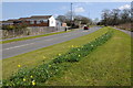
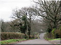
Road at Hawkesley
This road on the southern edge of the housing estate at Hawkesley is also on the southern boundary of the West Midlands urban conurbation. A couple of hundred metres to the south is the boundary between the West Midlands and the county of Worcestershire.
Image: © Philip Halling
Taken: 20 Apr 2013
0.18 miles
6
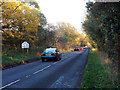
Saturday afternoon on Redhill Road, Redhill
Entering Wythall, a characteristic suburban implant in the Arden countryside.
Image: © Robin Stott
Taken: 30 Nov 2013
0.18 miles
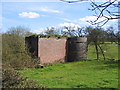
7
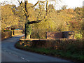
By Redhill Road, an air shaft to Wasthill Tunnel on the Worcester and Birmingham Canal
Image: © Robin Stott
Taken: 30 Nov 2013
0.19 miles
8
Wast Hill Tunnel ventilation shaft
The tunnel on the Worcester and Birmingham Canal runs under the hills between Image and Image and in doing so travels from the built up areas of the West Midlands to the rural surroundings near Alvechurch.
Image: © David Stowell
Taken: 14 Apr 2006
0.21 miles
9
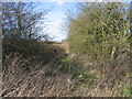
Overgrown towing horse path.
The overgrown path from Redhill Road to the northern portal of Wast Hill canal tunnel. In the days of horse drawn narrowboats when the tunnel was built the horses would have been led along this route over the top whilst the boats were legged through the tunnel.
Image: © David Stowell
Taken: 14 Apr 2006
0.21 miles