
IMAGES TAKEN NEAR TO
Pendrell Close, BIRMINGHAM, B37 5LS
Introduction
This page details the photographs taken nearby to Pendrell Close, B37 5LS by members of the Geograph project.
The Geograph project started in 2005 with the aim of publishing, organising and preserving representative images for every square kilometre of Great Britain, Ireland and the Isle of Man.

There are currently over 7.5m images from over14,400 individuals and you can help contribute to the project by visiting https://www.geograph.org.uk
Image Map
Images are licensed for reuse under creativecommons.org/licenses/by-sa/2.0
Notes
- Clicking on the map will re-center to the selected point.
- The higher the marker number, the further away the image location is from the centre of the postcode.
Image Listing (23 Images Found)
Images are licensed for reuse under creativecommons.org/licenses/by-sa/2.0
Image
Details
Distance
1
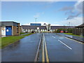
St Anne's Catholic Primary School
Adjacent to the church of the same name, on Bosworth Drive.
Image: © Richard Law
Taken: 27 Feb 2014
0.05 miles
2
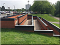
Pedestrian ramp and steps near Chelmsley Wood shopping centre, east Birmingham
To the right and behind the camera is open space beside the River Cole and a footbridge over it.
Image: © Robin Stott
Taken: 9 Jun 2018
0.10 miles
3
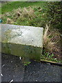
OS benchmark & rivet, Chelmsley Wood
A rather faint OS cutmark and associated rivet on the parapet of the bridge carrying Bosworth Drive over the Kingshurst Brook. Originally levelled at 85.478m above Ordnance Datum Newlyn.
Image: © Richard Law
Taken: 27 Feb 2014
0.11 miles
5

Chelmsley Wood
The rear of the Royal Mail Sorting Office and Telephone Exchange building.
Image: © Carl Baker
Taken: 11 Sep 2006
0.13 miles
6
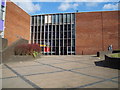
Chelmsley Wood Shopping Centre
The main entrance to the late 1960s shopping centre.
Image: © Carl Baker
Taken: 7 Sep 2006
0.13 miles

8
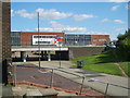
Chelmsley Wood
Chelmsley Wood Shopping Centre in the background.
Image: © Carl Baker
Taken: 7 Sep 2006
0.14 miles
9

Bosworth Road nearing the Asda superstore
Image: © Peter Whatley
Taken: 16 Feb 2013
0.14 miles
10
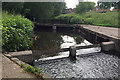
Weir and footbridge on the Kingshurst Brook, Chelmsley Wood, east Birmingham
The brook feeds the lake in Meriden Park before joining the River Cole Image On the map it's called the Hatchford Brook upstream. The houses in the background are in Grantley Drive.
Image: © Robin Stott
Taken: 9 Jun 2018
0.14 miles