
IMAGES TAKEN NEAR TO
Conway Road, BIRMINGHAM, B37 5LD
Introduction
This page details the photographs taken nearby to Conway Road, B37 5LD by members of the Geograph project.
The Geograph project started in 2005 with the aim of publishing, organising and preserving representative images for every square kilometre of Great Britain, Ireland and the Isle of Man.

There are currently over 7.5m images from over14,400 individuals and you can help contribute to the project by visiting https://www.geograph.org.uk
Image Map
Images are licensed for reuse under creativecommons.org/licenses/by-sa/2.0
Notes
- Clicking on the map will re-center to the selected point.
- The higher the marker number, the further away the image location is from the centre of the postcode.
Image Listing (13 Images Found)
Images are licensed for reuse under creativecommons.org/licenses/by-sa/2.0
Image
Details
Distance
1
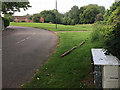
A bend on Conway Road, Bacon?s End, east Birmingham
This pleasant development near the River Cole (among the trees) doesn't always get the respect it deserves from some residents (or flytippers). Blocks of flats on Forth Drive, Keele House and Bangor House, can be seen over the trees Image
Image: © Robin Stott
Taken: 9 Jun 2018
0.06 miles
2
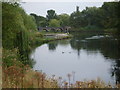
Meriden Park lake
Hatchford Brook forms this small lake and then flows into the River Cole.
Image: © Carl Baker
Taken: 12 Sep 2006
0.11 miles
3
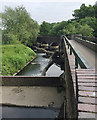
Footbridge across the lake, Meriden Park, Chelmsley Wood, east Birmingham
The lake is fed by the Hatchford Brook which flows northeast to swell the River Cole. The level of the lake is maintained by an elaborate weir below the footbridge.
Image: © Robin Stott
Taken: 9 Jun 2018
0.14 miles
5
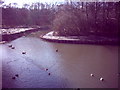
Meriden Park lake
Park is in the centre of the Chelmsley Wood housing estate.
Image: © Carl Baker
Taken: 1 Jan 2003
0.16 miles
6
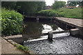
Weir and footbridge on the Kingshurst Brook, Chelmsley Wood, east Birmingham
The brook feeds the lake in Meriden Park before joining the River Cole Image On the map it's called the Hatchford Brook upstream. The houses in the background are in Grantley Drive.
Image: © Robin Stott
Taken: 9 Jun 2018
0.16 miles
7
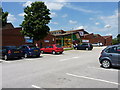
North Solihull Sports Centre
Council-run Sport & Leisure facilities on Chelmsley Road in Fordbridge.
Image: © Richard Law
Taken: 13 Jun 2014
0.17 miles
8

Boardwalk, Meriden Park, Bacon?s End, east Birmingham
A sign nearby explains that the boardwalk was constructed to allow easy access by a scrape and lessen human impact. The scrape was a piece of habitat creation – a shallow excavation with a high water table to support a range of plants, animals and insects. There is no evidence of it, only grasses, nettles and alder seedlings. The seed source is to the right: mixed oak and alder woodland identified as Chelmsley Wood, a local nature reserve of Solihull MBC. Plant dynamics rule!
Image: © Robin Stott
Taken: 9 Jun 2018
0.17 miles
10
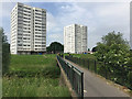
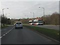
14-storey blocks of flats overlooking the River Cole, Bacon's End, east Birmingham
Westham House, left, and Wedgewood House form one of the many pairs of tower blocks on the North Solihull skyline. The white and grey colouring makes them seem less substantial. No cladding in sight, only concrete. A successful balance has been struck between landscaped open space, lots of it, for people, and more naturalistic management of the river corridor: http://www.solihull.gov.uk/Portals/0/StrategiesPlansPolicies/LandscapeandEcology/Nature_Conservation_Strategy.pdf pages 8-9.
Image: © Robin Stott
Taken: 9 Jun 2018
0.20 miles