
IMAGES TAKEN NEAR TO
Kelsull Croft, BIRMINGHAM, B37 5HH
Introduction
This page details the photographs taken nearby to Kelsull Croft, B37 5HH by members of the Geograph project.
The Geograph project started in 2005 with the aim of publishing, organising and preserving representative images for every square kilometre of Great Britain, Ireland and the Isle of Man.

There are currently over 7.5m images from over14,400 individuals and you can help contribute to the project by visiting https://www.geograph.org.uk
Image Map
Images are licensed for reuse under creativecommons.org/licenses/by-sa/2.0
Notes
- Clicking on the map will re-center to the selected point.
- The higher the marker number, the further away the image location is from the centre of the postcode.
Image Listing (5 Images Found)
Images are licensed for reuse under creativecommons.org/licenses/by-sa/2.0
Image
Details
Distance
1
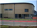
Grace Academy
The newly built Grace Academy on Chapelhouse Road.
Image: © Carl Baker
Taken: 11 Sep 2006
0.21 miles
2
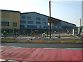
Grace Academy
The day before the schools first intake of pupils
Image: © Carl Baker
Taken: 11 Sep 2006
0.21 miles
3
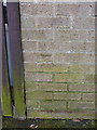
OS benchmark - Chelmsley Wood, 7 Camplea Croft
A slightly wonky OS cutmark in the bricks of no 7 Camplea Croft, facing onto Coleford Drive; originally levelled at 86.263m above Ordnance Datum Newlyn.
Image: © Richard Law
Taken: 27 Feb 2014
0.21 miles
4
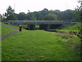
Bridge over Hatchford Brook.
This road bridge is on Gloucester Way.
Image: © Carl Baker
Taken: 11 Sep 2006
0.21 miles
5
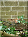
OS benchmark - Tile Cross, 112 Bosworth Drive
Hiding behind a small elder bush, the partly damaged remains of a 1969 OS cutmark that was levelled at 85.187m above Ordnance Datum Newlyn.
Image: © Richard Law
Taken: 30 May 2019
0.23 miles