IMAGES TAKEN NEAR TO
Loyns Close, BIRMINGHAM, B37 5AR
Introduction
This page details the photographs taken nearby to Loyns Close, B37 5AR by members of the Geograph project.
The Geograph project started in 2005 with the aim of publishing, organising and preserving representative images for every square kilometre of Great Britain, Ireland and the Isle of Man.

There are currently over 7.5m images from over14,400 individuals and you can help contribute to the project by visiting https://www.geograph.org.uk
Image Map
Images are licensed for reuse under creativecommons.org/licenses/by-sa/2.0
Notes
- Clicking on the map will re-center to the selected point.
- The higher the marker number, the further away the image location is from the centre of the postcode.
Image Listing (14 Images Found)
Images are licensed for reuse under creativecommons.org/licenses/by-sa/2.0
Image
Details
Distance
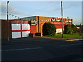
1
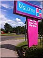
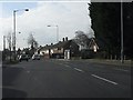
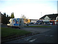
Fast food nation
Sign by junction of East Meadway (behind the photographer, as is Big Johns itself), Cooks Lane (ahead) and Chelmsley Road (to right)
Image: © A J Paxton
Taken: 9 Aug 2014
0.09 miles
2
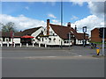
The White Hart Inn
The timber-framed heart of this Grade II listed https://www.britishlistedbuildings.co.uk/101211523-the-white-hart-public-house-shard-end-ward#.WyTUiadKiM8 public house is thought to be early 18th century, but it's been much altered over the years.
Image: © Richard Law
Taken: 26 Apr 2018
0.12 miles
3
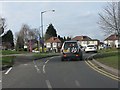
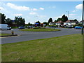
Chelmsley Road at Cooks Lane roundabout
Image: © Peter Whatley
Taken: 16 Feb 2013
0.12 miles
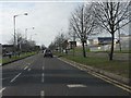
4
Roundabout on Cook's Lane
At the junction with Chelmsley Road.
Image: © Richard Law
Taken: 13 Jun 2014
0.12 miles
5
Fordbridge Social Club
On Saxon Way just off Chelmsley Road.
Image: © Carl Baker
Taken: 8 Oct 2006
0.12 miles
6
Craneberry Road, Tile Cross
The style of housing on Craneberry Road appears to indicate that it is the westernmost extremity of the enormous Chelmsley Wood housing development that is now largely located in Solihull borough. However, this end of Craneberry Road is still just in the City of Birmingham.
Image: © Richard Vince
Taken: 8 Dec 2012
0.13 miles
8
Shirestone Road turning circle, Tile Cross
This relatively small turning circle was once used by buses from Birmingham city centre via Bordesley Green and Meadway. However, since the construction of the vast Chelmsley Wood housing estate immediately east of here, most buses serving this end of Tile Cross Road (in front of the shops) have extended there. In the early 1980s there were still buses timetabled to turn here, but nothing has been scheduled to for many years, and the bus stop pole that I remember being here about ten years ago has disappeared. Shirestone Road appears to be a dual carriageway; however, the road in the foreground is in fact a service road for some blocks of flats, and runs parallel to Shirestone Road proper (just visible on the left).
Image: © Richard Vince
Taken: 8 Dec 2012
0.18 miles
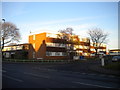
9
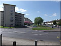
Shirestone Road viewed from Tile Cross Road
Shirestone Road is a street of 1950s Birmingham council housing. On the left can be seen the six blocks of 6-storey flats with their distinctive Y-shaped plan that were built in 1951 and named after country towns. Redditch House is in the foreground.
Image: © A J Paxton
Taken: 18 Apr 2014
0.19 miles