IMAGES TAKEN NEAR TO
Latelow Road, BIRMINGHAM, B33 8JZ

Introduction

This page details the photographs taken nearby to Latelow Road, B33 8JZ by members of the Geograph project.

The Geograph project started in 2005 with the aim of publishing, organising and preserving representative images for every square kilometre of Great Britain, Ireland and the Isle of Man.

There are currently over 7.5m images from over14,400 individuals and you can help contribute to the project by visiting https://www.geograph.org.uk

Image Map


Images are licensed for reuse under creativecommons.org/licenses/by-sa/2.0
Notes
  • Clicking on the map will re-center to the selected point.
  • The higher the marker number, the further away the image location is from the centre of the postcode.

Image Listing (11 Images Found)

Images are licensed for reuse under creativecommons.org/licenses/by-sa/2.0
Image
Details
Distance
1
Roundabout at Lea Hall
This large roundabout controls the traffic flow to and from this large housing estate at Lea Hall.
Image: © Peter Mackenzie Taken: 18 Apr 2017
0.11 miles
2
Railway bridge across Crossfield Road
Image: © Steve Fareham Taken: 29 May 2012
0.14 miles
3
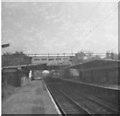
Lea Hall Station, Birmingham
Looking east at 'concrete jungle' that was Lea Hall Station - not particularly inviting architecture, but standard practice for stations (concrete) at time stations on this line were built.
Image: © Michael Westley Taken: Unknown
0.15 miles
4
Lea Hall railway station
Opened in 1939 by the London Midland & Scottish Railway on its line from Coventry to Birmingham. View south east towards Marston Green and Coventry.
Image: © Nigel Thompson Taken: 28 Nov 2011
0.17 miles
5
Lea Hall railway station
The car park and main entrance to Lea Hall railway station.
Image: © Peter Mackenzie Taken: 18 Apr 2017
0.18 miles
6
Lea Hall railway station
Opened in 1939 by the London Midland & Scottish Railway on its line from Coventry to Birmingham. View north west towards Stechford and Birmingham.
Image: © Nigel Thompson Taken: 28 Nov 2011
0.18 miles
7
Entrance to Lea Hall railway station
Once reputedly the most vandalised railway station in the West Midlands, much effort appears to have been made to improve Lea Hall station in recent times. The station building is accessed from a footbridge as the railway is in a cutting at this point.
Image: © Richard Vince Taken: 8 Dec 2012
0.21 miles
8
Meadway at the exit from Sheldon Heath Road
Image: © Peter Whatley Taken: 16 Feb 2013
0.22 miles
9
Lea Hall station turning circle
Now only served by buses passing through (hence the bus stops on both sides of the turning circle), for a while buses on route 15 (from Birmingham city centre via Hob Moor Road) turned here. The railway station is in a cutting behind the lunar themed fence.
Image: © Richard Vince Taken: 8 Dec 2012
0.23 miles
10
Access to Meadway from Sheldon Heath Road
Image: © Peter Whatley Taken: 16 Feb 2013
0.23 miles