IMAGES TAKEN NEAR TO
Elmstead Avenue, BIRMINGHAM, B33 0PQ
Introduction
This page details the photographs taken nearby to Elmstead Avenue, B33 0PQ by members of the Geograph project.
The Geograph project started in 2005 with the aim of publishing, organising and preserving representative images for every square kilometre of Great Britain, Ireland and the Isle of Man.

There are currently over 7.5m images from over14,400 individuals and you can help contribute to the project by visiting https://www.geograph.org.uk
Image Map
Images are licensed for reuse under creativecommons.org/licenses/by-sa/2.0
Notes
- Clicking on the map will re-center to the selected point.
- The higher the marker number, the further away the image location is from the centre of the postcode.
Image Listing (19 Images Found)
Images are licensed for reuse under creativecommons.org/licenses/by-sa/2.0
Image
Details
Distance
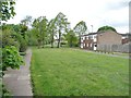
1
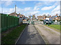
End of the cycleway
A small network of footpaths and cycle tracks runs through the Sheldon Country Park area; here is the point at which this particular one emerges into the housing estate on the north side of Sheldon.
Image: © Richard Law
Taken: 25 Feb 2014
0.06 miles
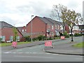
2
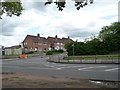
Elmstead Avenue
On the south-east side of The Radleys.
Image: © Christine Johnstone
Taken: 16 May 2012
0.12 miles
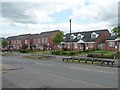
3
New houses, south side, The Radleys
With the grass verges carefully railed off to prevent cars parking there.
Image: © Christine Johnstone
Taken: 16 May 2012
0.13 miles
4
Lychgate Avenue, off The Radleys
A recent addition to both the housing stock and the road network, and about a kilometre from the nearest lych gate.
Image: © Christine Johnstone
Taken: 16 May 2012
0.14 miles
5
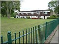
Western-most block, Radleys Walk
Built with only a path outside their front gardens, and an uninterrupted view of Radleys Park.
Image: © Christine Johnstone
Taken: 16 May 2012
0.15 miles
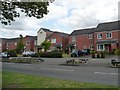
6
Newish houses at the Radleys
On the south side of the road called The Radleys.
Image: © Christine Johnstone
Taken: 16 May 2012
0.16 miles
7
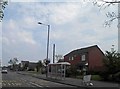
Bus stop on The Radleys
Under the flightpath from Birmingham airport.
Image: © Steve Fareham
Taken: 18 May 2012
0.16 miles
8
Flats on Radleys Walk
The path leads on across Radleys Park. Vehicle access is to the back of the flats.
Image: © Christine Johnstone
Taken: 16 May 2012
0.16 miles
9
Ragnall Avenue, off The Radleys
Closed to all but residents because of civil engineering on Willaston Road.
Image: © Christine Johnstone
Taken: 16 May 2012
0.17 miles
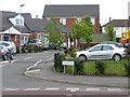
10
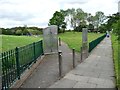
Entrance to Radleys Park
On the north side of the road called The Radleys. This part of Birmingham is full of parks and tree-lined streets.
Image: © Christine Johnstone
Taken: 16 May 2012
0.18 miles