IMAGES TAKEN NEAR TO
Dettonford Road, BIRMINGHAM, B32 4HE
Introduction
This page details the photographs taken nearby to Dettonford Road, B32 4HE by members of the Geograph project.
The Geograph project started in 2005 with the aim of publishing, organising and preserving representative images for every square kilometre of Great Britain, Ireland and the Isle of Man.

There are currently over 7.5m images from over14,400 individuals and you can help contribute to the project by visiting https://www.geograph.org.uk
Image Map
Images are licensed for reuse under creativecommons.org/licenses/by-sa/2.0
Notes
- Clicking on the map will re-center to the selected point.
- The higher the marker number, the further away the image location is from the centre of the postcode.
Image Listing (13 Images Found)
Images are licensed for reuse under creativecommons.org/licenses/by-sa/2.0
Image
Details
Distance
1
Field Lane at Bartley Green Social Club
Image: © Peter Whatley
Taken: 10 Mar 2012
0.01 miles
2

St. Michael and All Angels Church, Bartley Green
The parish church of St. Michael and All Angels, Bartley Green. It dates from 1966 and replaced a victorian church which was not in the centre of the expanding village. The architect was H Norman Haines.
Image: © Andrew Abbott
Taken: 25 Mar 2010
0.03 miles
3
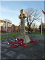
Bartley Green War Memorial
Erected in 1920 as a WW1 memorial in a churchyard about 400 yards away, and moved to its present location in the 1960s. 19 local men who fell in the First World War are commemorated, along with several who gave their lives in the Second World War. The memorial was Grade II listed https://britishlistedbuildings.co.uk/101432584-bartley-green-war-memorial-bartley-green-ward & https://historicengland.org.uk/listing/the-list/list-entry/1432584 in 2016.
Image: © Richard Law
Taken: 20 Jan 2020
0.04 miles
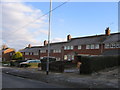
4
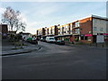
Shops & flats on Curdale Road, Woodgate
Image: © Richard Law
Taken: 20 Jan 2020
0.04 miles
5
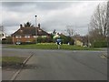
Scotland Lane meets Field Lane, Bartley Green
Image: © Peter Whatley
Taken: 10 Mar 2012
0.08 miles
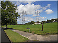
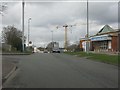
7
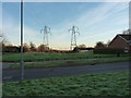
Open ground and power lines north of Field Lane, Woodgate
Image: © Richard Law
Taken: 20 Jan 2020
0.14 miles
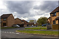
9
Numbers 22 to 38, Romsley Road, Bartley Green, Birmingham
Row of terraced houses in Bartley Green.
Image: © Roy Hughes
Taken: 3 Jan 2009
0.18 miles
