IMAGES TAKEN NEAR TO
Harts Green Close, BIRMINGHAM, B32 3AQ
Introduction
This page details the photographs taken nearby to Harts Green Close, B32 3AQ by members of the Geograph project.
The Geograph project started in 2005 with the aim of publishing, organising and preserving representative images for every square kilometre of Great Britain, Ireland and the Isle of Man.

There are currently over 7.5m images from over14,400 individuals and you can help contribute to the project by visiting https://www.geograph.org.uk
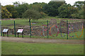
Image Map
Images are licensed for reuse under creativecommons.org/licenses/by-sa/2.0
Notes
- Clicking on the map will re-center to the selected point.
- The higher the marker number, the further away the image location is from the centre of the postcode.
Image Listing (14 Images Found)
Images are licensed for reuse under creativecommons.org/licenses/by-sa/2.0
Image
Details
Distance
1
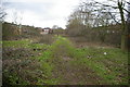
Footpath along the Bourn Brook, near California
Looking NW
Image: © Phil Champion
Taken: 27 Jan 2007
0.07 miles
2
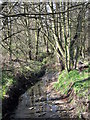
Bourn Brook Just About to Pass Under California Way Harborne
Image: © Roy Hughes
Taken: 27 Mar 2012
0.10 miles
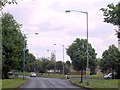
3
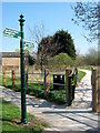
Bourn Brook Walkway California Way Harborne
Image: © Roy Hughes
Taken: 27 Mar 2012
0.10 miles
5
California Way with Stonehouse Lane on the Right
Image: © Roy Hughes
Taken: 24 May 2011
0.13 miles
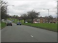
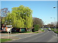
6
Sunny California
These trees beside California Way, in the south of this square have now all but lost their leaves for the winter but still lend a splash of colour with the low angle of the sun.
Image: © David Stowell
Taken: 11 Dec 2005
0.18 miles
7
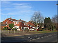
California Way
Some of the modern housing development adjacent to California Way.
Image: © David Stowell
Taken: 11 Dec 2005
0.18 miles

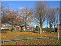
9
Weoley Castle
Surrounded by a housing estate, it has evidently been considered prudent to surround the remains of Weoley Castle with a substantial fence; at most times visitors can only look on and read a couple of information boards. Despite the name, this was never a proper castle but a fortified medieval manor house, dating from the 1270s. It had a moat, towers and battlements but no keep and its location in the valley of the Bourn Brook was not a true defensive position.
Image: © Stephen McKay
Taken: 3 Oct 2015
0.21 miles