
IMAGES TAKEN NEAR TO
Ridgacre Road, BIRMINGHAM, B32 1JS
Introduction
This page details the photographs taken nearby to Ridgacre Road, B32 1JS by members of the Geograph project.
The Geograph project started in 2005 with the aim of publishing, organising and preserving representative images for every square kilometre of Great Britain, Ireland and the Isle of Man.

There are currently over 7.5m images from over14,400 individuals and you can help contribute to the project by visiting https://www.geograph.org.uk
Image Map
Images are licensed for reuse under creativecommons.org/licenses/by-sa/2.0
Notes
- Clicking on the map will re-center to the selected point.
- The higher the marker number, the further away the image location is from the centre of the postcode.
Image Listing (29 Images Found)
Images are licensed for reuse under creativecommons.org/licenses/by-sa/2.0
Image
Details
Distance
1
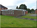
Quinton Evangelical Church
This one doesn't really need a title, the name is clear to see. The church lies on World's End Lane (rather ironically, I thought) at the junction with Ridgeacre Road.
Image: © Richard Law
Taken: 2 Oct 2019
0.05 miles
2
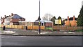
Quinton Evangelical Church
This church is on the corner of Worlds End Lane and Ridgacre Road. In 2016 or 2017 the fence shown replaced a hedge along the road frontage.
Image: © Paul Collins
Taken: 17 Nov 2017
0.05 miles
3
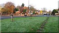
Young Trees on Roundabout in Ridgacre Road
This roundabout sports several carefully planted young trees including a tiny fir visible in the centre of this image.
Image: © Paul Collins
Taken: 17 Nov 2017
0.06 miles
4
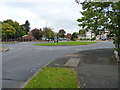
Roundabout on Ridgacre Road
At the junction with Worlds End Lane.
Image: © Richard Law
Taken: 2 Oct 2019
0.07 miles
6
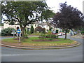
World's End Lane Roundabout
The well maintained floral displays on the roundabout at the junction of World's End Lane and Quinton Lane.
Image: © David Stowell
Taken: 2 Jul 2006
0.13 miles
7
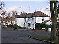
Quinton, Green Lane, Birdlip Road Junction
Image: © Roy Hughes
Taken: 5 Mar 2009
0.15 miles
8
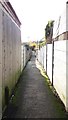
Alleyway Between Glyn Farm Road and Higgins Lane
An old lamp standard survives midway along the alleyway.
Image: © Paul Collins
Taken: 17 Nov 2017
0.15 miles
9
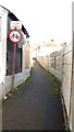
Alleyway Between Higgins Lane and Glyn Farm Road
The 'Cycling Prohibited' enamel sign is a rare survivor. But no problem - a local wit tells us that 'scooters are better'.
Image: © Paul Collins
Taken: 17 Nov 2017
0.15 miles
10
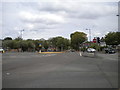
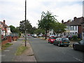
Ridgacre Road, Quinton
Looking towards Birmingham city centre at the junction with Ridgacre Lane.
Image: © Richard Vince
Taken: 28 Jul 2018
0.15 miles