
IMAGES TAKEN NEAR TO
Fairfax Road, BIRMINGHAM, B31 3RT
Introduction
This page details the photographs taken nearby to Fairfax Road, B31 3RT by members of the Geograph project.
The Geograph project started in 2005 with the aim of publishing, organising and preserving representative images for every square kilometre of Great Britain, Ireland and the Isle of Man.

There are currently over 7.5m images from over14,400 individuals and you can help contribute to the project by visiting https://www.geograph.org.uk
Image Map
Images are licensed for reuse under creativecommons.org/licenses/by-sa/2.0
Notes
- Clicking on the map will re-center to the selected point.
- The higher the marker number, the further away the image location is from the centre of the postcode.
Image Listing (6 Images Found)
Images are licensed for reuse under creativecommons.org/licenses/by-sa/2.0
Image
Details
Distance
1
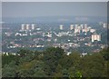
South-west Birmingham, an overview (2)
From Beacon Hill, Lickey.
Image: © Jeff Gogarty
Taken: 17 Aug 2016
0.11 miles
2
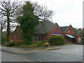
The Fordrough
A modern pub at the junction of The Fordrough and West Heath Road.
The gridline splits the building - the side facing is in SP0278.
Image: © Jonathan Billinger
Taken: 28 Jan 2009
0.12 miles
3
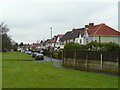
Inter-war housing on West Heath Road
Looking north towards Turves Green.
Image: © Jonathan Billinger
Taken: 28 Jan 2009
0.13 miles
4
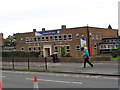
Turves Green Girls School, Northfield, Birmingham
Official name Turves Green Girls' School and Technology College, Birmingham.
There is a primary school separating the girls and boys high schools.
Image: © Jeff Gogarty
Taken: 28 Sep 2016
0.21 miles
5
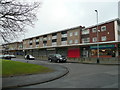
Shops on Fairfax Road, Turves Green
Note the large proportion with shutters down at noon on a Wednesday.
Image: © Jonathan Billinger
Taken: 28 Jan 2009
0.23 miles
6

Parish Hall at St Anne's church
Located on Alvechurch Road, and immediately adjacent to the much newer and more imposing Image
Image: © Richard Law
Taken: 26 Feb 2020
0.24 miles