1
Interior of St Laurence, Northfield
St Laurence is grade 1 listed, and deservedly so, for it is full of interest as well as being well-kept and well-lit. Visible in this shot is the nave, the unspoilt C13th chancel and the mediaeval roof with its wooden tympanum.
Image: © Paul Collins
Taken: 9 Sep 2023
0.10 miles
2
Church of St Laurence, Northfield
An historic sandstone church, with parts dating back to the 12th, 13th, 14th & 15th centuries, and some alterations in the meantime including a north aisle around 1900. The whole attracted a first class Grade I listing https://britishlistedbuildings.co.uk/101075684-church-of-st-laurence-northfield-ward#.XyLf3ShKjcs & https://historicengland.org.uk/listing/the-list/list-entry/1075684 in 1952.
Image: © Richard Law
Taken: 8 Jan 2020
0.10 miles
3
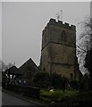
St Laurence Church, Northfield
Image: © Noisar
Taken: 17 Jan 2017
0.10 miles
4
St Laurence's church, Northfield, Birmingham
Image: © Dave Kelly
Taken: 7 Mar 2009
0.10 miles
5
The (former) outhouse to the Rectory, Northfield
This building, of which the half-timbered portion on the right is probably 16th century, and the brick-built portion on the left dates more to the 18th, was once an outhouse to the nearby Rectory. It was converted to garages, and now appears to be in use as offices. The whole structure was Grade II listed https://britishlistedbuildings.co.uk/101220878-outhouse-to-the-rectory-now-garages-between-the-rectory-and-the-pastoral-centre-northfield-ward#.XyLdTyhKjcs & https://historicengland.org.uk/listing/the-list/list-entry/1220878 in 1982.
Image: © Richard Law
Taken: 8 Jan 2020
0.10 miles
6
View from the Chancel, St Laurence, Northfield
St Laurence is grade 1 listed, and deservedly so, for it is full of interest as well as being well-kept and well-lit. Visible in this shot is a little of the unspoilt C13th chancel and the mediaeval roof.
Image: © Paul Collins
Taken: 9 Sep 2023
0.11 miles
7
Northfield church, Ordnance Survey bolt
Ordnance Survey bolt in north side of tower of St Lawrence's Church. This bench mark was established in 1844 during the First primary levelling of England & Wales, and was levelled with a height of 558.557 feet above mean sea level (Liverpool datum). It was included as a side level on the Manchester to Gloucester levelling line, Branch Levelling Mark No. 339.
Image: © Shantavira
Taken: 28 Nov 2011
0.11 miles
8
Northfield Conservation Area
Great Stone Inn and The Pound looking towards St Laurence Church lych gate and tower.
Image: © John Stuart Andrew
Taken: 2 Sep 2018
0.11 miles
9
7, 9 and 11 Church Hill, Northfield
Cottages on Church Hill, Northfield in Birmingham.
Image: © Andrew Abbott
Taken: 29 Apr 2018
0.12 miles
10
Church Hill, Northfield
Church Hill drops down fairly steeply from the old village core by St Laurence Church towards the railway station.
Image: © Stephen McKay
Taken: 3 Oct 2015
0.12 miles


