1
Bournville Harriers hut, King's Norton Playing Fields
Alongside car park for playing fields. A bit worse for wear
Image: © Michael Westley
Taken: 2 May 2022
0.14 miles
2
King's Norton - house at canal junction
This house is at the junction of the Stratford-on-Avon Canal with the Birmingham & Worcester Canal. The church in the background to the right of the house is King's Norton Church.
Image: © Dave Bevis
Taken: 24 Mar 2008
0.17 miles
3
Under Wraps
Canal toll house in process of being renovated
Image: © Michael Westley
Taken: 2 May 2022
0.17 miles
4
Guillotine lock under renovation
This is one of two guillotine lock gates on the Stratford Canal at King's Norton. They were to separate the waters of the two canal companies at a junction and have not been used since the waterways were nationalised after WWII. The gate is seen top centre and an operating windlass is bottom left. The Stratford Canal was drained at the lock for work on the chamber. This was a public open day.
Image: © Chris Allen
Taken: 9 Dec 2012
0.17 miles
5
Canal Junction, King's Norton
This is the Worcester & Birmingham Canal with Junction House opposite. The Stratford Canal joins from the left and is out of view.
Image: © Chris Allen
Taken: 9 Dec 2012
0.17 miles
6
Toll House, King's Norton Junction
This is the Toll House where the Stratford-upon-Avon Canal (built in stages c1793-1815) meets the earlier Worcester and Birmingham Canal (built in stages c1791-1815). The Grade II Listed http://www.britishlistedbuildings.co.uk/en-217364-canal-house-at-junction-of-worcester-and building at the junction was the first office of the Worcester and Birmingham Canal Company and doubled as a toll house.
Taken from the roving bridge over the Worcester and Birmingham Canal.
Image: © David P Howard
Taken: 9 Dec 2012
0.17 miles
7
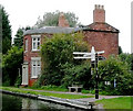
The Old Canal House and Finger Post, King's Norton
The derelict canal house and finger post at the junction of the Stratford-on-Avon Canal and Worcester-Birmingham Canal at King's Norton, Birmingham
Image: © Noisar
Taken: 8 Jan 2019
0.17 miles
8
BP Filling Station on Pershore Road South, King's Norton
Petrol & diesel prices were around £1.26 per litre at the time this photo was taken in late 2019.
Image: © Richard Law
Taken: 16 Dec 2019
0.17 miles
9
Toll house at King's Norton Junction, Birmingham
Here is where the Stratford-upon-Avon Canal (built in stages c1793-1815) meets the earlier Worcester and Birmingham Canal (built in stages c1791-1815). The Grade II Listed 1796 building at the junction was the first office of the Worcester and Birmingham Canal Company and doubled as a toll house. A commemorative board listing some mileages and tolls now shows above the door.
In the image, Worcester is ahead, and Birmingham is behind the camera. Warwick and Stratford off to the left.
Image: © Roger D Kidd
Taken: 25 Aug 2010
0.18 miles
10
Toll House, King's Norton Junction, Birmingham
Here is where the Stratford-upon-Avon Canal (built in stages c1793-1815) meets the earlier Worcester and Birmingham Canal (built in stages c1791-1815). The Grade II Listed 1796 building at the junction was the first office of the Worcester and Birmingham Canal Company and doubled as a toll house. A commemorative board listing some mileages and tolls now shows above the door.
Image]
In the image, taken on another grey autumn day in 2008, Worcester is to the left, and Birmingham to the right. Warwick and Stratford are back behind the camera!
Image: © Roger D Kidd
Taken: 8 Sep 2008
0.18 miles


