1
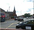
Rowheath Road, Cotteridge
Seen from near the junction with Watford Road.
Image: © Richard Vince
Taken: 10 Mar 2018
0.14 miles
2
East end of Northfield Road, Cotteridge
Seen from Watford Road.
Image: © Richard Vince
Taken: 10 Mar 2018
0.14 miles
3
Royal Mail Kings Norton Delivery Office, Watford Road, Cotteridge
Like the railway station, this delivery office is actually in Cotteridge but takes its name from the rather more upmarket area a little way south.
Image: © Richard Vince
Taken: 10 Mar 2018
0.17 miles
4
Royal Mail Kings Norton Delivery Office, Watford Road, Cotteridge (detail)
The stone above the front door, indicating a build date of 1939 in the reign of King George VI.
Image: © Richard Vince
Taken: 10 Mar 2018
0.17 miles
5
Nursery Close, Cotteridge
Image: © Alex McGregor
Taken: 25 May 2010
0.17 miles
6
Telephone Exchange, King's Norton
Located at 56 Northfield Road, this TE would appear to date from the 1930s. It serves King's Norton plus Cotteridge, Hawkesley, Lifford and West Heath nearby. KINg's Norton numbers were provided by this TE until the late 1960s. Now, it has 0121-433, 451, 458, 459 and 486 xxxx numbers. The postcode of this TE is B30 1JH.
Image: © David Hillas
Taken: 1 Sep 2011
0.20 miles
7
The Lifford curve
Image: © David Stowell
Taken: 2 Jul 2006
0.21 miles
8
Watford Road, Cotteridge, 1993
The outer ring road [Watford Rd] at Cotteridge, Birmingham in 1993
Image: © Rob Newman
Taken: Unknown
0.22 miles
9
Pershore Rd, Cotteridge, 1993
Pershore Road at Cotteridge, Birmingham, looking towards the city in 1993
Image: © Rob Newman
Taken: Unknown
0.23 miles
10
Watford Road, Cotteridge
Here Watford Road, the A4040, meets Pershore Road, the A441 going left towards Stirchly. Past Cotteridge Church the A4040 continues as Pershore Road South whilst the B4121 goes right towards Northfield.
Image: © Gerald England
Taken: 6 Jul 2024
0.24 miles


