
IMAGES TAKEN NEAR TO
Prestwood Road, BIRMINGHAM, B29 5EA
Introduction
This page details the photographs taken nearby to Prestwood Road, B29 5EA by members of the Geograph project.
The Geograph project started in 2005 with the aim of publishing, organising and preserving representative images for every square kilometre of Great Britain, Ireland and the Isle of Man.

There are currently over 7.5m images from over14,400 individuals and you can help contribute to the project by visiting https://www.geograph.org.uk
Image Map
Images are licensed for reuse under creativecommons.org/licenses/by-sa/2.0
Notes
- Clicking on the map will re-center to the selected point.
- The higher the marker number, the further away the image location is from the centre of the postcode.
Image Listing (19 Images Found)
Images are licensed for reuse under creativecommons.org/licenses/by-sa/2.0
Image
Details
Distance
1
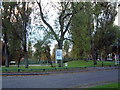
Shenley Fields
This park also has a popular fishing lake. It is on the Selly Oak edge of Weoley Castle, Birmingham. A few yards behind the photographer is the Raven public house.
Image: © Chris Hoare
Taken: 31 Oct 2006
0.04 miles
2
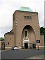
Our Lady and St Rose of Lima Church, Weoley Castle Birmingham
Image: © Roy Hughes
Taken: 8 Jun 2011
0.05 miles
3
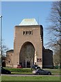
Church of Our Lady and St Rose of Lima, Weoley Castle
Church by Adrian Gilbert Scott, opened in 1961
Image: © Andrew Abbott
Taken: 6 Apr 2015
0.05 miles
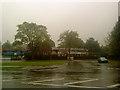
8
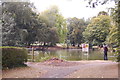
Pond by Shenley Fields Road
The pond is seen from the road at the western end of the recreation ground.
Image: © Trevor Harris
Taken: 23 Aug 2011
0.17 miles
10
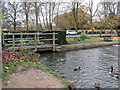
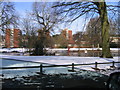
Pool, Shenley Fields Road & Start of Wood Brook
The Wood Brook starts here as an outfall of the lake on Shenley Fields Road. After a short distance it joins Griffins Brook to form The Bourn. The Bourn passes through the Cadbury Factory works and joins the Rea in Stirchley.
Image: © Roy Hughes
Taken: 23 Nov 2011
0.18 miles