
IMAGES TAKEN NEAR TO
Abdon Avenue, BIRMINGHAM, B29 4PG
Introduction
This page details the photographs taken nearby to Abdon Avenue, B29 4PG by members of the Geograph project.
The Geograph project started in 2005 with the aim of publishing, organising and preserving representative images for every square kilometre of Great Britain, Ireland and the Isle of Man.

There are currently over 7.5m images from over14,400 individuals and you can help contribute to the project by visiting https://www.geograph.org.uk
Image Map
Images are licensed for reuse under creativecommons.org/licenses/by-sa/2.0
Notes
- Clicking on the map will re-center to the selected point.
- The higher the marker number, the further away the image location is from the centre of the postcode.
Image Listing (65 Images Found)
Images are licensed for reuse under creativecommons.org/licenses/by-sa/2.0
Image
Details
Distance
1
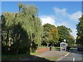
Bus shelter by bridge over Griffin's Brook
Image: © David Smith
Taken: 23 Oct 2019
0.04 miles
2
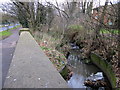
Griffin's Brook, Bristol Road South with Shopping Trolley
Image: © Roy Hughes
Taken: 26 Dec 2011
0.06 miles
3
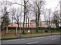
Bournville College, Partly Demolished
Image: © Roy Hughes
Taken: 26 Dec 2011
0.07 miles
4
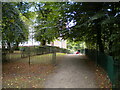
Footpath to Woodbrooke Grove, Northfield
Off Bristol Road South.
Image: © Richard Vince
Taken: 3 Sep 2022
0.07 miles
5
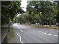
Bristol Road South, Northfield
The central reservation was formerly used by trams.
Image: © Richard Vince
Taken: 3 Sep 2022
0.08 miles
6
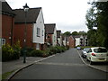
Woodbrooke Grove, Northfield
Part of a housing development apparently designed to hinder pedestrian access.
Image: © Richard Vince
Taken: 3 Sep 2022
0.09 miles
7
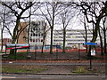
We Have Moved - Bournville College Awaiting Demolition
Image: © Roy Hughes
Taken: 26 Dec 2011
0.12 miles
8
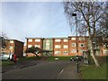
Lincoln Court, Tugford Road
A late 1950s, early 1960s housing estate in south Birmingham.
Image: © Andrew Abbott
Taken: 27 Dec 2016
0.13 miles
9
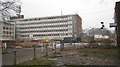
Can't go yet
The likelihood is this part of the former Bournville College cannot be demolished until the phone mast on roof is decommissioned / moved.
The building in view was 2 sides of a square - the 2 other sides in front having been levelled.
The building just in shot on right, the Stan Banting Centre, is now home for security / demolition staff.
Image: © Michael Westley
Taken: 12 Feb 2012
0.13 miles
10
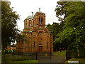
Serbian Orthodox Church of the Holy Prince Lazar
Image: © Andrew Abbott
Taken: 17 Jul 2010
0.13 miles