IMAGES TAKEN NEAR TO
Corvedale Road, BIRMINGHAM, B29 4LA
Introduction
This page details the photographs taken nearby to Corvedale Road, B29 4LA by members of the Geograph project.
The Geograph project started in 2005 with the aim of publishing, organising and preserving representative images for every square kilometre of Great Britain, Ireland and the Isle of Man.

There are currently over 7.5m images from over14,400 individuals and you can help contribute to the project by visiting https://www.geograph.org.uk
Image Map
Images are licensed for reuse under creativecommons.org/licenses/by-sa/2.0
Notes
- Clicking on the map will re-center to the selected point.
- The higher the marker number, the further away the image location is from the centre of the postcode.
Image Listing (85 Images Found)
Images are licensed for reuse under creativecommons.org/licenses/by-sa/2.0
Image
Details
Distance
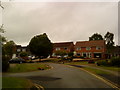
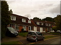
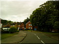
2
Junction of Corvedale Road and Eymore Close
Image: © Andrew Abbott
Taken: 29 May 2010
0.03 miles
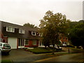
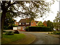
7
St Denis Road, Birmingham
Towards the junction with Chedworth Close. Part of the Bournville Village Trust
Image: © Andrew Abbott
Taken: 29 Apr 2018
0.04 miles
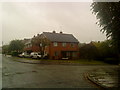
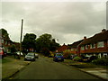
9
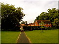
Eymore Close from Northfield Manor Farm Park
Image: © Andrew Abbott
Taken: 29 May 2010
0.07 miles