
IMAGES TAKEN NEAR TO
York Road, BIRMINGHAM, B28 8BB
Introduction
This page details the photographs taken nearby to York Road, B28 8BB by members of the Geograph project.
The Geograph project started in 2005 with the aim of publishing, organising and preserving representative images for every square kilometre of Great Britain, Ireland and the Isle of Man.

There are currently over 7.5m images from over14,400 individuals and you can help contribute to the project by visiting https://www.geograph.org.uk
Image Map
Images are licensed for reuse under creativecommons.org/licenses/by-sa/2.0
Notes
- Clicking on the map will re-center to the selected point.
- The higher the marker number, the further away the image location is from the centre of the postcode.
Image Listing (34 Images Found)
Images are licensed for reuse under creativecommons.org/licenses/by-sa/2.0
Image
Details
Distance
1
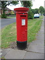
Elizabeth II postbox on Cateswell Road, Birmingham
Postbox No. B28 974.
Image: © JThomas
Taken: 6 May 2017
0.06 miles
2
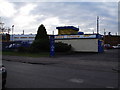
Hall Green Stadium, York Road, Birmingham
Greyhound Racing stadium
Image: © peter lloyd
Taken: 23 Dec 2005
0.08 miles
3
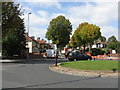
Cateswell Lane - Shaftmoor Lane roundabout
Image: © Peter Whatley
Taken: 12 Sep 2011
0.09 miles
4
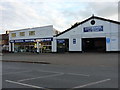
The Ian Farrell Motor Company garage
Purveyors of used cars and servicing, repairs, MOTs etc to the local area.
Image: © Richard Law
Taken: 12 Sep 2018
0.09 miles
5
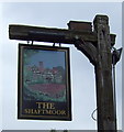
Sign for the Shaftmoor public house, Hall Green
Image: © JThomas
Taken: 6 May 2017
0.11 miles
6
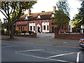
The Shaftsmoor public house
Located pretty much at the junction of Shaftsmoor Lane and Cateswell Road
Image: © Richard Law
Taken: 12 Sep 2018
0.12 miles
7
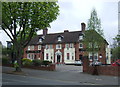
The Shaftmoor public house, Hall Green
On Shaftmoor Lane.
Image: © JThomas
Taken: 6 May 2017
0.12 miles
8
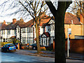
Cateswell Road, Hall Green
Detached and semi-detached houses on Cateswell Road seen from Shaftmoor Lane.
Image: © Stephen McKay
Taken: 21 Dec 2015
0.14 miles
9
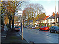
Cateswell Road, Hall Green
Seen from the Shaftmoor Lane Roundabout. The bus stop is served by route 40 operated by West Midlands Special Needs Transport.
Image: © Stephen McKay
Taken: 21 Dec 2015
0.14 miles
10
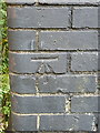
OS benchmark - Hall Green, railway bridge on York Road
An OS cutmark on the brick parapet of the railway bridge; originally levelled, probably in 1965, at 133.8m above Ordnance Datum Newlyn.
Image: © Richard Law
Taken: 12 Sep 2018
0.14 miles