
IMAGES TAKEN NEAR TO
Scribers Lane, BIRMINGHAM, B28 0PP
Introduction
This page details the photographs taken nearby to Scribers Lane, B28 0PP by members of the Geograph project.
The Geograph project started in 2005 with the aim of publishing, organising and preserving representative images for every square kilometre of Great Britain, Ireland and the Isle of Man.

There are currently over 7.5m images from over14,400 individuals and you can help contribute to the project by visiting https://www.geograph.org.uk
Image Map
Images are licensed for reuse under creativecommons.org/licenses/by-sa/2.0
Notes
- Clicking on the map will re-center to the selected point.
- The higher the marker number, the further away the image location is from the centre of the postcode.
Image Listing (16 Images Found)
Images are licensed for reuse under creativecommons.org/licenses/by-sa/2.0
Image
Details
Distance
2
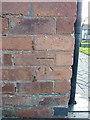
OS benchmark - Yardley Wood, 31 Barton Lodge Road
An OS cutmark on the wall of the house; originally levelled, probably in 1965, at 140.00m above Ordnance Datum Newlyn.
Image: © Richard Law
Taken: 18 Apr 2018
0.16 miles
3
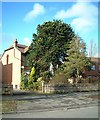
Baldwins Lane
Araucaria araucana
Image: © araucaria araucana
Taken: 14 Feb 2011
0.17 miles
4
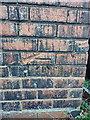
OS benchmark - Yardley Wood, 179 Baldwins Lane
An OS cutmark on the side wall of no 179 Baldwins Lane; originally levelled, probably in 1965, at 143.76m above Ordnance Datum Newlyn.
Image: © Richard Law
Taken: 18 Apr 2018
0.17 miles
5
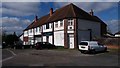
Parade on Scribers Lane
This parade does not appear to be thriving and has been partly converted to residential and office use. See Image for an older view.
Image: © Paul Collins
Taken: 2 Apr 2017
0.18 miles
6
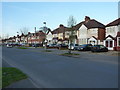
Fading light on houses in Baldwins Lane
Image: © Richard Law
Taken: 18 Apr 2018
0.19 miles
7
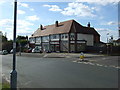
Shops on Scribers Lane
Shops pictured on the corner of Scribers Lane and Tixall Road in Hall Green, Birmingham.
Image: © Simon Dean
Taken: 15 Sep 2007
0.20 miles
8
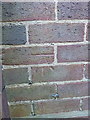
OS benchmark - Yardley Wood, 265 Baldwins Lane
An OS cutmark on the wall of 265 Baldwins Lane (currently a doctors' surgery) which was originally levelled, probably in 1965, at 143.11m above Ordnance Datum Newlyn.
Image: © Richard Law
Taken: 18 Apr 2018
0.21 miles
9
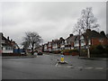
South end of Barton Lodge Road, Hall Green
Seen from Baldwins Lane.
Image: © Richard Vince
Taken: 10 Mar 2018
0.23 miles
10
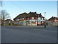
Right Price and Baldwin's Pizza
Two landmark businesses on Baldwins Road in Yardley Wood
Image: © Richard Law
Taken: 18 Apr 2018
0.23 miles