
IMAGES TAKEN NEAR TO
Oakhill Crescent, BIRMINGHAM, B27 7LU
Introduction
This page details the photographs taken nearby to Oakhill Crescent, B27 7LU by members of the Geograph project.
The Geograph project started in 2005 with the aim of publishing, organising and preserving representative images for every square kilometre of Great Britain, Ireland and the Isle of Man.

There are currently over 7.5m images from over14,400 individuals and you can help contribute to the project by visiting https://www.geograph.org.uk
Image Map
Images are licensed for reuse under creativecommons.org/licenses/by-sa/2.0
Notes
- Clicking on the map will re-center to the selected point.
- The higher the marker number, the further away the image location is from the centre of the postcode.
Image Listing (7 Images Found)
Images are licensed for reuse under creativecommons.org/licenses/by-sa/2.0
Image
Details
Distance
1
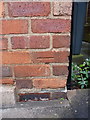
OS benchmark - Hall Green, 116 Severne Road
An OS benchmark on the wall of no 116 Severne Road; originally levelled at 130.223m above Ordnance Datum Newlyn.
Image: © Richard Law
Taken: 13 Dec 2016
0.08 miles
2
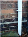
OS benchmark - Hall Green, 23 Overton Road
An OS cutmark on the wall of 23 Overton Road; originally levelled at 133.533m above Ordnance Datum Newlyn.
Image: © Richard Law
Taken: 13 Dec 2016
0.10 miles
3
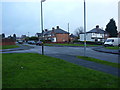
Overton Road in Olton
The main street here is Overton Road, with Chisholm Grove on the right, and Overton Grove to the left.
Image: © Richard Law
Taken: 13 Dec 2016
0.11 miles
4
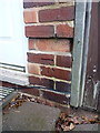
OS benchmark - Olton, 195 Severne Road
An OS cutmark on the front wall of 195 Severne Road; originally levelled at 132.311m above Ordnance Datum Newlyn.
Image: © Richard Law
Taken: 13 Dec 2016
0.11 miles
5
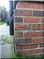
OS benchmark - Olton, 64 Severne Road
The slightly damaged remains of an OS cutmark on the wall of 64 Severne Road; originally levelled at 125.43m above Ordnance Datum Newlyn.
Image: © Richard Law
Taken: 13 Dec 2016
0.16 miles
6
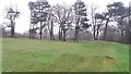
Fox Hollies Park
This park was laid out in the early 1930s. Despite some low-level anti-social behaviour such as motorcycle riding (tracks are visible in the photo) it remains a pleasant place to visit. I am not an expert but what looks like ridge and furrow appears to be visible to the left of the larger mounds which are for BMX.
Image: © Paul Collins
Taken: 17 Jan 2017
0.21 miles
7
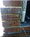
OS benchmark - Olton, 65 Severne Road
An OS cutmark on the side wall of no 65 Severne Road; originally levelled at 119.17m above Ordnance Datum Newlyn.
Image: © Richard Law
Taken: 13 Dec 2016
0.24 miles