
IMAGES TAKEN NEAR TO
Dolphin Lane, BIRMINGHAM, B27 7BE
Introduction
This page details the photographs taken nearby to Dolphin Lane, B27 7BE by members of the Geograph project.
The Geograph project started in 2005 with the aim of publishing, organising and preserving representative images for every square kilometre of Great Britain, Ireland and the Isle of Man.

There are currently over 7.5m images from over14,400 individuals and you can help contribute to the project by visiting https://www.geograph.org.uk
Image Map
Images are licensed for reuse under creativecommons.org/licenses/by-sa/2.0
Notes
- Clicking on the map will re-center to the selected point.
- The higher the marker number, the further away the image location is from the centre of the postcode.
Image Listing (13 Images Found)
Images are licensed for reuse under creativecommons.org/licenses/by-sa/2.0
Image
Details
Distance
1
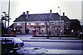
The Dolphin, Acocks Green
An M&B Public House, almost opposite Oxford Road, between Victoria Road and Dolphin Lane. Since demolished, this substantial plot of land is now the home of Aldi (food supermarket). See also Image]
Image: © Michael Westley
Taken: Unknown
0.07 miles
2
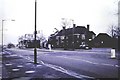
The Dolphin, Acocks Green
Public House on Warwick Road, alongside junctions with Victoria Road and Oxford Road. The pub has since been demolished and replaced with an Aldi foodstore. This was the last pub before Warwick Road dropped down towards Olton 'Hollow'.
The road sign for station / car park is directing traffic down Oxford Road, to station and car park off Roberts Road. Oxford Road allows cars wishing to join outer ring road towards Yardley and avoiding AG village centre.
See also Image]
Image: © Michael Westley
Taken: Unknown
0.07 miles
3
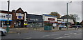
Businesses on Warwick Road, Acock's Green
The date stone in the archway gable reads 1929.
Image: © Paul Collins
Taken: 12 Nov 2021
0.09 miles
4
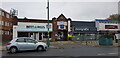
Businesses on Warwick Road, Acock's Green
The date stone in the archway gable reads 1929.
Image: © Paul Collins
Taken: 12 Nov 2021
0.09 miles
5
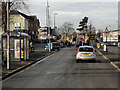
Acock's Green, Warwick Road
The A41, Warwick Road, passing through Acock's Green.
Image: © David Dixon
Taken: 21 Dec 2012
0.09 miles
6
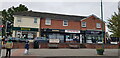
Businesses on Warwick Road, Acock's Green
The Warwick Road shopping area of Acock's Green always seems quite bustling. In this parade, service businesses predominate.
Image: © Paul Collins
Taken: 12 Oct 2021
0.11 miles
7

Birmingham this way
Signs at the roundabout intersection on Warwick Road. Olton Boulevard East is ahead.
Image: © Peter Whatley
Taken: 11 Feb 2012
0.11 miles

9

Businesses on Warwick Road, Acock's Green
Picture taken at 9am on a weekday morning. Perhaps some of these businesses had not yet opened up for the day, or maybe not since the pandemic.
Image: © Paul Collins
Taken: 12 Oct 2021
0.13 miles
10

Holy Souls Church, Acocks Green
On Warwick Road, in centre of AG village, opposite shops. The Catholic Church had its own secondary school on connected land behind. At time of this photo, the land to the right had been sold and awaiting development of large supermarket.
I regularly attended this church in my teens/early 20s, and my father (Eric Westley) was a volunteer tutor at the junior school opposite (having retired early as teacher from Moseley School).
Image: © Michael Westley
Taken: Unknown
0.18 miles