IMAGES TAKEN NEAR TO
New Coventry Road, BIRMINGHAM, B26 3FF
Introduction
This page details the photographs taken nearby to New Coventry Road, B26 3FF by members of the Geograph project.
The Geograph project started in 2005 with the aim of publishing, organising and preserving representative images for every square kilometre of Great Britain, Ireland and the Isle of Man.

There are currently over 7.5m images from over14,400 individuals and you can help contribute to the project by visiting https://www.geograph.org.uk
Image Map
Images are licensed for reuse under creativecommons.org/licenses/by-sa/2.0
Notes
- Clicking on the map will re-center to the selected point.
- The higher the marker number, the further away the image location is from the centre of the postcode.
Image Listing (12 Images Found)
Images are licensed for reuse under creativecommons.org/licenses/by-sa/2.0
Image
Details
Distance
1
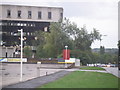
Dereliction on the A45?
The office block on the left is now unoccupied and heavily vandalised. The building was once the main office of the Glynwed Group.
The city centre direction carriage way of Coventry Road, Birmingham (A45) is on the right. This is, actually, a rather wide central reservation.
Image: © John Evans
Taken: 26 Aug 2006
0.07 miles
2
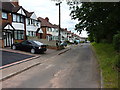
Old Coventry Road
Houses on the north side of the older route of the Coventry Road, now bypassed by a dual carriageway just behind the trees on the right.
Image: © Richard Law
Taken: 4 Jul 2014
0.08 miles
3
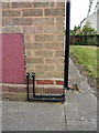
OS benchmark - Lyndon End, 1990 Coventry Road
An OS cutmark at the side of no 1990 Coventry Road; originally levelled at 108.81m above Ordnance Datum Newlyn.
Image: © Richard Law
Taken: 4 Jul 2014
0.10 miles
4
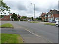
Brays Road nd Herondale Road junction
A junction on the extensive housing estate at Gilbertstone
Image: © Richard Law
Taken: 4 Jul 2014
0.13 miles
5
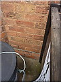
OS benchmark - Gilbertstone, 60 Brays Road
An OS cutmark on the front face of no 60 Brays Road; originally levelled a 11.06m above Ordnance Datum Newlyn.
Image: © Richard Law
Taken: 4 Jul 2014
0.14 miles
6
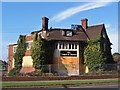
The Wagon & Horses, Coventry Road, Sheldon, Birmingham, awaiting its fate
Image: © Ann Causer
Taken: Unknown
0.14 miles
7
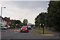
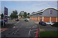
Birmingham : Wagon Lane
Looking along Wagon Lane at the junction with New Coventry Road.
Image: © Lewis Clarke
Taken: 1 Jul 2015
0.14 miles
8
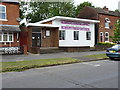
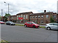
The Sheldon Gospel Hall
Situated at the southern end of Barrows Lane, and shared with (if not completely taken over by) a dance studio.
Image: © Richard Law
Taken: 4 Jul 2014
0.15 miles