
IMAGES TAKEN NEAR TO
Coventry Road, BIRMINGHAM, B26 3EA
Introduction
This page details the photographs taken nearby to Coventry Road, B26 3EA by members of the Geograph project.
The Geograph project started in 2005 with the aim of publishing, organising and preserving representative images for every square kilometre of Great Britain, Ireland and the Isle of Man.

There are currently over 7.5m images from over14,400 individuals and you can help contribute to the project by visiting https://www.geograph.org.uk
Image Map
Images are licensed for reuse under creativecommons.org/licenses/by-sa/2.0
Notes
- Clicking on the map will re-center to the selected point.
- The higher the marker number, the further away the image location is from the centre of the postcode.
Image Listing (19 Images Found)
Images are licensed for reuse under creativecommons.org/licenses/by-sa/2.0
Image
Details
Distance
1
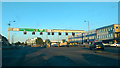
Birmingham : Coventry Road A45
Looking along the A45 while waiting at the traffic lights.
Image: © Lewis Clarke
Taken: 30 Jun 2015
0.11 miles
2
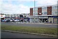
Shops on Coventry Road, Sheldon
Including Iceland, Sheldon News, Marie Curie and PDSA.
Image: © Gerald England
Taken: 26 Sep 2021
0.11 miles
3
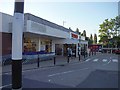
Birmingham : Tesco Store
A Tesco store on Coventry Road.
Image: © Lewis Clarke
Taken: 30 Jun 2015
0.13 miles
4
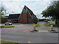
Lyndon Methodist Church
A church on the junction of Beamans Close and Lyndon Road.
Image: © Richard Law
Taken: 7 Aug 2014
0.19 miles
5
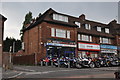
Birmingham : Sheldon Motorcycle Centre
A motorcycle centre on Coventry Road. Beside it Crimestop and Discount Hospital Catalogue Returns are based.
Image: © Lewis Clarke
Taken: 1 Jul 2015
0.20 miles
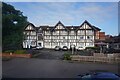
7
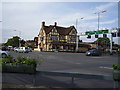
Sheldon Travelodge
A45. Coventry Road.
Image: © Anthony Vosper
Taken: 25 May 2011
0.21 miles
8
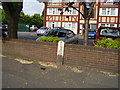
The Dividing line
The boundary between the 'posh bit' Solihull and the city of Birmingham,
Hobs Moat Road.
Image: © Anthony Vosper
Taken: 25 May 2011
0.21 miles
9
Boundary Marker, Hob's Moat Road
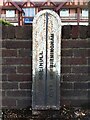
Located near the junction with Coventry Road. The Travelodge Birmingham Sheldon can be seen behind it. The city of Birmingham extended its boundaries into this area in 1931, taking in much of Sheldon parish and a small piece of Solihull north of Coventry Road https://www.british-history.ac.uk/vch/warks/vol7/pp1-3. The marker was presumably installed then, and still stands on or near to the boundary. It appears to be made of cast iron, now pitted with rust, and painted white with the place names and boundary line picked out in black.
Image: © A J Paxton
Taken: 14 Aug 2014
0.21 miles
10
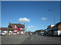
Hob's Moat Road Approaching A45 Coventry Road
Image: © Roy Hughes
Taken: 7 Mar 2016
0.21 miles