IMAGES TAKEN NEAR TO
Fort Parkway, BIRMINGHAM, B24 9FQ

Introduction

This page details the photographs taken nearby to Fort Parkway, B24 9FQ by members of the Geograph project.

The Geograph project started in 2005 with the aim of publishing, organising and preserving representative images for every square kilometre of Great Britain, Ireland and the Isle of Man.

There are currently over 7.5m images from over14,400 individuals and you can help contribute to the project by visiting https://www.geograph.org.uk

Image Map


Images are licensed for reuse under creativecommons.org/licenses/by-sa/2.0
Notes
  • Clicking on the map will re-center to the selected point.
  • The higher the marker number, the further away the image location is from the centre of the postcode.

Image Listing (35 Images Found)

Images are licensed for reuse under creativecommons.org/licenses/by-sa/2.0
  • ...
Image
Details
Distance
1
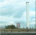
Chimney - Bromford Power Station
Image: © Anthony Parkes Taken: 17 Oct 2013
0.08 miles
2
The Jaguar factory seen from Fort Dunlop
A view from the first floor offices at Fort Dunlop of the huge Jaguar factory, the corner seen here actually being in the next gridsquare. The factory building itself is almost 1 kilometre long and was used to build Spitfires in World War II. This is the southern side of the building which faces Fort Parkway.
Image: © John Brightley Taken: 20 Apr 2010
0.10 miles
3
View from first floor offices at Fort Dunlop
A view of the landscaping surrounding the building, with the huge Jaguar factory behind.
Image: © John Brightley Taken: 20 Apr 2010
0.11 miles
4
The Castle Bromwich Jaguar plant
Image: © Steve Daniels Taken: 8 Apr 2014
0.11 miles
5
Fort Dunlop
The covers have come off the building work at the Fort Dunlop redevelopment.
Image: © John M Taken: 30 Mar 2007
0.12 miles
6
The M6 side of Fort Dunlop
Image: © Dave Croker Taken: 5 Apr 2008
0.13 miles
7
Fort Dunlop
Down at car park level, the associated pictures were taken from a room on the top floor of the hotel building (blue end).
Image: © Neil Owen Taken: 2 May 2010
0.13 miles
8
Fort Dunlop
Picture taken whilst travelling north on the M6
Image: © gary radford Taken: 28 Feb 2004
0.14 miles
9
Close by the M6
The elevated road is the M6 and the River Tame runs between the railway track and the motorway.
Image: © Malcolm Neal Taken: 8 Jul 2019
0.14 miles
10
Rear of Fort Dunlop
Image: © Dave Croker Taken: 5 Apr 2008
0.15 miles
  • ...