
IMAGES TAKEN NEAR TO
Oval Road, BIRMINGHAM, B24 8PP
Introduction
This page details the photographs taken nearby to Oval Road, B24 8PP by members of the Geograph project.
The Geograph project started in 2005 with the aim of publishing, organising and preserving representative images for every square kilometre of Great Britain, Ireland and the Isle of Man.

There are currently over 7.5m images from over14,400 individuals and you can help contribute to the project by visiting https://www.geograph.org.uk
Image Map
Images are licensed for reuse under creativecommons.org/licenses/by-sa/2.0
Notes
- Clicking on the map will re-center to the selected point.
- The higher the marker number, the further away the image location is from the centre of the postcode.
Image Listing (41 Images Found)
Images are licensed for reuse under creativecommons.org/licenses/by-sa/2.0
Image
Details
Distance
1
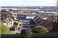
Towards Bromford
The view SW from Erdington Oval. Somewhere down there there's the A38, the M6, the A47 and the River Tame.
Image: © Adrian Bailey
Taken: 27 Feb 2005
0.03 miles
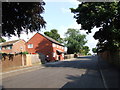
4
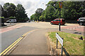
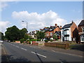
A slightly confusing junction on Gravelly Hill
Both southbound roads have to give way, but who to? I think traffic coming up the hill gets priority.
Image: © Bill Boaden
Taken: 29 Jun 2023
0.16 miles
6
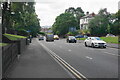
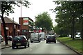
Gravelly Hill
A descent on the A5127 down to the junction of the M6 and A38. The junction shares its name with this road and the local area.
Image: © Bill Boaden
Taken: 29 Jun 2023
0.16 miles
7
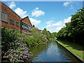
Birmingham and Fazeley Canal near Gravelly Hill in Birmingham
Looking east-north-east towards Fazeley, between the two Troutpool Bridges.
Image: © Roger Kidd
Taken: 20 Aug 2012
0.17 miles
8
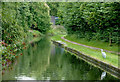
Birmingham and Fazeley Canal near Gravelly Hill, Birmingham
Approaching Troutpool Bridge, out of sight past the bend.
The Birmingham and Fazeley Canal was completed in 1789 having been engineered and supervised by John Smeaton. It linked Birmingham (Farmer's Bridge Junction) with the Coventry Canal at Fazeley Junction, fifteen miles in length, with 38 locks. An extension along part of the Coventry Canal route to Whittington was added later.
Image: © Roger D Kidd
Taken: 29 Aug 2012
0.18 miles
9
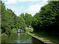
Birmingham and Fazeley Canal near Gravelly Hill in Birmingham
Looking east-north-east towards Fazeley.
Image: © Roger Kidd
Taken: 20 Aug 2012
0.18 miles
10
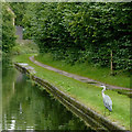
Canal towpath with heron near Gravelly Hill, Birmingham
Approaching Troutpool Bridge, out of sight past the bend.
The Birmingham and Fazeley Canal was completed in 1789 having been engineered and supervised by John Smeaton. It linked Birmingham (Farmer's Bridge Junction) with the Coventry Canal at Fazeley Junction, fifteen miles in length, with 38 locks. An extension along part of the Coventry Canal route to Whittington was added later.
Image: © Roger D Kidd
Taken: 29 Aug 2012
0.18 miles