
IMAGES TAKEN NEAR TO
Eversley Dale, BIRMINGHAM, B24 8JS
Introduction
This page details the photographs taken nearby to Eversley Dale, B24 8JS by members of the Geograph project.
The Geograph project started in 2005 with the aim of publishing, organising and preserving representative images for every square kilometre of Great Britain, Ireland and the Isle of Man.

There are currently over 7.5m images from over14,400 individuals and you can help contribute to the project by visiting https://www.geograph.org.uk
Image Map
Images are licensed for reuse under creativecommons.org/licenses/by-sa/2.0
Notes
- Clicking on the map will re-center to the selected point.
- The higher the marker number, the further away the image location is from the centre of the postcode.
Image Listing (15 Images Found)
Images are licensed for reuse under creativecommons.org/licenses/by-sa/2.0
Image
Details
Distance
1
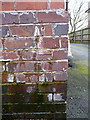
OS benchmark - Birches Green, Lad in the Lane
An OS cutmark on the wall of the pub that is now the Lad in the Lane, but was formerly the Green Man; originally levelled at 113.18m above Ordnance Datum Newlyn.
Image: © Richard Law
Taken: 28 Feb 2017
0.07 miles
2
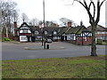
The Lad in the Lane public house
A remarkable survivor of the middle ages - parts of this Grade II listed building date back to the 14th & 15th centuries, and there has been an inn on the site since 1306. http://www.britishlistedbuildings.co.uk/en-216828-the-lad-in-the-lane-public-house-#.WMED82-LSM8
Image: © Richard Law
Taken: 28 Feb 2017
0.07 miles
3
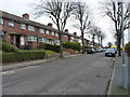
Erdington Hall Road
Residential street in the Birches Green area of north Brum.
Image: © Richard Law
Taken: 28 Feb 2017
0.11 miles
4
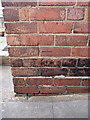
OS benchmark - Birhces Green, 15 Erdington Hall Road
An OS cutmark on the side wall of the house; originally levelled at 103.5m above Ordnance Datum Newlyn.
Image: © Richard Law
Taken: 28 Feb 2017
0.12 miles
5
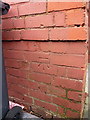
OS benchmark - Gravelly Hill, 84 Erdington Hall Road
An OS cutmark on the side wall of the house, normally hidden behind the wheelie bin. We had to move the bin to expose it. Originally levelled at 102.06m above Ordnance Datum Newlyn.
Image: © Richard Law
Taken: 28 Feb 2017
0.14 miles
6
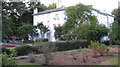
Rookery House, Erdington
Awaiting restoration it seems, but with idyllic gardens, and access (on left of photo) into Rookery Park
http://www.rookery-house.co.uk/index.htm
Image: © Michael Westley
Taken: 10 Aug 2010
0.17 miles
10
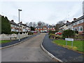
Bisley Grove, Birches Green
A quiet cul-de-sac of houses, just off Glenthorne Road.
Image: © Richard Law
Taken: 28 Feb 2017
0.22 miles