
IMAGES TAKEN NEAR TO
Sycamore Crescent, BIRMINGHAM, B24 8DF
Introduction
This page details the photographs taken nearby to Sycamore Crescent, B24 8DF by members of the Geograph project.
The Geograph project started in 2005 with the aim of publishing, organising and preserving representative images for every square kilometre of Great Britain, Ireland and the Isle of Man.

There are currently over 7.5m images from over14,400 individuals and you can help contribute to the project by visiting https://www.geograph.org.uk
Image Map
Images are licensed for reuse under creativecommons.org/licenses/by-sa/2.0
Notes
- Clicking on the map will re-center to the selected point.
- The higher the marker number, the further away the image location is from the centre of the postcode.
Image Listing (16 Images Found)
Images are licensed for reuse under creativecommons.org/licenses/by-sa/2.0
Image
Details
Distance
1
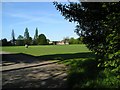
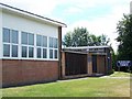
Jaffray Playing Fields, Erdington
Named after John Jaffray, as was the hospital, road and school all in the same area.
Born in Stirling, he moved to Birmingham in 1844, to work for John Frederick Feeney on the Birmingham Journal, and became a partner in it in 1852. Together they founded the Birmingham Daily Post, (now Birmingham Post) in 1857. He founded the Birmingham Mail with Feeney's son John Feeney in 1870.
He was president of Birmingham General Hospital and founded Birmingham's Jaffray Hospital.
Image: © Ann
Taken: 5 May 2006
0.12 miles
2
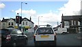
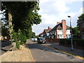
Oakfield Road / Wood End Road
Road junction - outer ring road, close to six ways Erdington (off to the left)
Image: © Michael Westley
Taken: 18 Aug 2010
0.13 miles
6
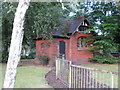
Former public toilets, Rookery Park
Boarded up toilets in corner of Rookery Park, facing Wood End Road
Image: © Michael Westley
Taken: 10 Aug 2010
0.18 miles
8
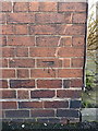
OS benchmark - Erdington, corner of Fentham Road
An OS cutmark on the S angle of the Yenton Assembly Rooms building (formerly the Masonic Hall) on the corner of Fentham Road; originally levelled in 1956 at 123.988m above Ordnance Datum Newlyn.
Image: © Richard Law
Taken: 28 Feb 2017
0.20 miles
9
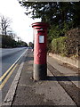
Georgian postbox on Gravelly Hill North
Box B23 203D situated on the west side of the road. Miraculously, it appears to have avoided being knocked down by traffic in all these years (I hope saying that doesn't curse it)
Image: © Richard Law
Taken: 28 Feb 2017
0.20 miles
10
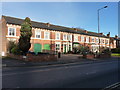
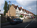
Terraced houses on Gravelly Hill North
A row of (probably) Victorian terraced houses on the west side of the road. The apparent carriage entrances under each pair make for an unusual feature, but they seem to have escaped the listing process.
Image: © Richard Law
Taken: 28 Feb 2017
0.21 miles