IMAGES TAKEN NEAR TO
Aylesford Road, BIRMINGHAM, B21 8DN
Introduction
This page details the photographs taken nearby to Aylesford Road, B21 8DN by members of the Geograph project.
The Geograph project started in 2005 with the aim of publishing, organising and preserving representative images for every square kilometre of Great Britain, Ireland and the Isle of Man.

There are currently over 7.5m images from over14,400 individuals and you can help contribute to the project by visiting https://www.geograph.org.uk
Image Map
Images are licensed for reuse under creativecommons.org/licenses/by-sa/2.0
Notes
- Clicking on the map will re-center to the selected point.
- The higher the marker number, the further away the image location is from the centre of the postcode.
Image Listing (11 Images Found)
Images are licensed for reuse under creativecommons.org/licenses/by-sa/2.0
Image
Details
Distance
1
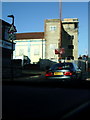
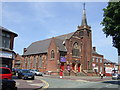
Gurdwara Bebe Nanaki Ji, Handsworth
Construction underway on Rookery Road, Handsworth
Image: © Michael Westley
Taken: 17 Jan 2010
0.05 miles
3

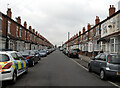
Houses on Rookery Rd
Victorian red brick terraces mostly two storey but with the occasional three storey pair such as these ones thrown in. the shops further along which would have been houses at one time include a convenience store and a fish and chip shop.
Image: © Nigel Mykura
Taken: 13 Jul 2011
0.14 miles
4
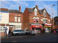
Houses and Shops Rookery Rd
The old house that housed a launderette has been burned out completely and boarded up. Someone still lives next door. In the next door pair of semi-detached properties there is a Kurdistani Halal butcher and an elctronics shop that also handles Western Union money transfers.
Image: © Nigel Mykura
Taken: 13 Jul 2011
0.16 miles
5
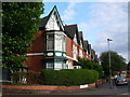
Junction of Carlton Avenue and Westbourne Rd Handsworth
This house with an octagonal oriel corner window and its pseudo-Gothic arches over the smaller window is of a superior style to most of the Victorian terraces in Handsworth. The road also has considerable greenery including a tree line garden in the middle of the street. The house gardens at the rear of each property themselves are very small , not much more than yards
Image: © Nigel Mykura
Taken: 13 Jul 2011
0.17 miles
7

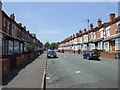
Westbourne Road
One of the long residential streets made up of Victorian terraced housing that makes up the bulk of the housing stock in Handsworth.
Image: © Nigel Mykura
Taken: 13 Jul 2011
0.19 miles
8
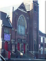
Trinity Methodist Church, Handsworth
Church on Rookery Road, Handsworth close to junction with Oxhill Road.
Image: © Michael Westley
Taken: 17 Jan 2010
0.20 miles
9
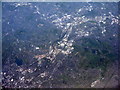
Handsworth from the air
Looking west from over the M6 at Gravelly Hill. The stadium is the Hawthorns, the home of West Bromwich Albion FC. The motorway heading off centre-right is the M5. The two distinct lines from lower left to upper right are the Birmingham Canal and Birmingham-Wolverhampton railway, passing through Smethwick and Sandwell, and the body of water is Edgbaston Reservoir.
Image: © M J Richardson
Taken: 4 May 2016
0.20 miles