IMAGES TAKEN NEAR TO
Arlington Road, BIRMINGHAM, B14 4QD
Introduction
This page details the photographs taken nearby to Arlington Road, B14 4QD by members of the Geograph project.
The Geograph project started in 2005 with the aim of publishing, organising and preserving representative images for every square kilometre of Great Britain, Ireland and the Isle of Man.

There are currently over 7.5m images from over14,400 individuals and you can help contribute to the project by visiting https://www.geograph.org.uk
Image Map
Images are licensed for reuse under creativecommons.org/licenses/by-sa/2.0
Notes
- Clicking on the map will re-center to the selected point.
- The higher the marker number, the further away the image location is from the centre of the postcode.
Image Listing (7 Images Found)
Images are licensed for reuse under creativecommons.org/licenses/by-sa/2.0
Image
Details
Distance
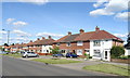
2
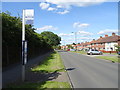
Bus stop on Highters Heath Lane, Birmingham
Image: © JThomas
Taken: 22 Jun 2019
0.10 miles
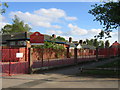
4
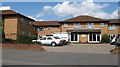
Servite Care Home, Glenavon Road
Where once stood St Judes Catholic Church (until 70s), now stands one of many Servite homes. http://www.housingcare.org/housing-care/facility-info-80305-servite-court-highters-heath-england.aspx
Image: © Michael Westley
Taken: 27 May 2010
0.19 miles
5
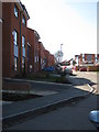
Whitlock Grove, Maypole
New housing development 'The Edge' on high ground, just off Warstock Road
http://www.smartnewhomes.com/development/details/The_Edge_Lovell_Partnerships_%28Midlands%29.aspx
Image: © Michael Westley
Taken: 7 Mar 2011
0.23 miles
6
Highter's Heath Junior and Infant Schools
The schools in Highter's Heath Lane near the junction with Warstock Road.
Image: © David Stowell
Taken: 26 May 2006
0.23 miles
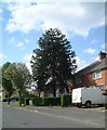
7
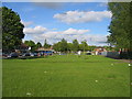
Highter's Heath
The green area on the other side of School Lane from the Image Unfortunately the grass seems to be suffering a little from urban dandruff!
Image: © David Stowell
Taken: 26 May 2006
0.23 miles