1
Retail building under construction
The steelwork for a new retail development goes up on the corner of Oxford Road and St Marys Row. Formerly Meteor Ford, the site was to have been primarily a Tesco store but is now planned principally to be a Marks & Spencer food store.
Image: © Paul Collins
Taken: 22 Jul 2016
0.01 miles
2
Supermarket Under Construction, Oxford Road
The new Marks & Spencer grocery store continues to take shape. See
Image The St Mary's Row frontage contains a number individual shop units with more traditionally-styled shop fronts. The medical centre on site has been aborted and sheltered accommodation is being included instead. The site was formerly the Meteor Ford car dealership.
Image: © Paul Collins
Taken: 1 Jul 2017
0.02 miles
3
Building under construction
The building under construction is to be a Marks & Spencer grocery store and, if reports are accurate, a medical centre. The site was formerly occupied by the Meteor Ford car dealership. This view is from Oxford Road.
Image: © Paul Collins
Taken: 20 Aug 2016
0.03 miles
4
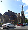
Calvary Church of God in Christ
This church on Oxford Road straddles a grid line. The left hand half is in
Image and the right hand half is in
Image http://www.birminghamchurches.org.uk/churches/calvary-church-of-god-in-christ-moseley/
Image: © David P Howard
Taken: 22 Nov 2012
0.03 miles
5
Calvary Church of God in Christ
Image: © JThomas
Taken: 22 Jun 2019
0.03 miles
6
Retail building under construction
The building under construction is to be primarily be a Marks & Spencer grocery store and, if reports are accurate, a medical centre. The site was formerly the Meteor Ford car dealership. The 'Camp Hill Line' railway runs in a tunnel below the road just in front of the photographer.
Image: © Paul Collins
Taken: 20 Aug 2016
0.04 miles
7
Approaching a church in Oxford Road
Now called The Calvary Church of God in Christ, I believe it was built as a Baptist Church.
Image: © Basher Eyre
Taken: 20 Aug 2013
0.04 miles
8
Baptist Church, Oxford St
Grade II listed. http://www.britishlistedbuildings.co.uk/en-217560-church-of-st-mary-birmingham
Image: © N Chadwick
Taken: 11 Jun 2011
0.04 miles
9
Oxford St, Moseley
Image: © N Chadwick
Taken: 11 Jun 2011
0.04 miles
10
Supermarket Under Construction, Oxford Road
A new Marks & Spencer grocery store complex continues to take shape. Here bricklayers are building the boundary walls at the corner of Oxford Road and St Mary's Row. The site was formerly the Meteor Ford car dealership.
Image: © Paul Collins
Taken: 1 Jul 2017
0.05 miles


