IMAGES TAKEN NEAR TO
Wold Walk, BIRMINGHAM, B13 0JT
Introduction
This page details the photographs taken nearby to Wold Walk, B13 0JT by members of the Geograph project.
The Geograph project started in 2005 with the aim of publishing, organising and preserving representative images for every square kilometre of Great Britain, Ireland and the Isle of Man.

There are currently over 7.5m images from over14,400 individuals and you can help contribute to the project by visiting https://www.geograph.org.uk
Image Map
Images are licensed for reuse under creativecommons.org/licenses/by-sa/2.0
Notes
- Clicking on the map will re-center to the selected point.
- The higher the marker number, the further away the image location is from the centre of the postcode.
Image Listing (11 Images Found)
Images are licensed for reuse under creativecommons.org/licenses/by-sa/2.0
Image
Details
Distance
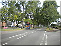
1
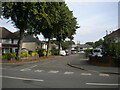
Picton Grove, Billesley
Seen from its junction with Bromwall Road.
Image: © Richard Vince
Taken: 3 Sep 2022
0.09 miles
2
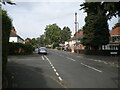
Bromwall Road, Billesley
At its junction with Hopton Grove.
Image: © Richard Vince
Taken: 3 Sep 2022
0.11 miles
3
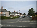
Colemeadow Road, Billesley
Seen from its junction with Bromwall Road.
Image: © Richard Vince
Taken: 3 Sep 2022
0.13 miles
4
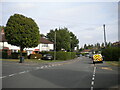
Hullbrook Road, Billesley
Seen at its junction with Bromwall Road (left) and Selborne Grove.
Image: © Richard Vince
Taken: 3 Sep 2022
0.14 miles
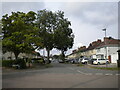
5
Yardley Wood Road, Billesley
Seen from its junction with Bromwall Road.
Image: © Richard Vince
Taken: 3 Sep 2022
0.19 miles
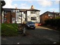
6
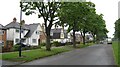
Housing, Yardley Wood Road
Houses on Yardley Wood Road near Billesley Common
Image: © Michael Westley
Taken: 1 Jun 2010
0.19 miles
7
Beauchamp Road, Billesley
At its junction with Hullbrook Road.
Image: © Richard Vince
Taken: 3 Sep 2022
0.19 miles
8
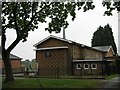
Community of Christ, Yardley Wood
On Yardley Wood Road, opposite Bromwall Road
Image: © Michael Westley
Taken: 1 Jun 2010
0.21 miles
9
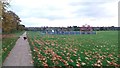
Children's Play Area on Billesley Common
Image: © Paul Collins
Taken: 6 Nov 2016
0.22 miles
10
Birmingham-Yardley Wood Road
Former Council Houses.
Image: © Ian Rob
Taken: 2 Sep 2012
0.23 miles