IMAGES TAKEN NEAR TO
Siskin Drive, BIRMINGHAM, B12 9LW
Introduction
This page details the photographs taken nearby to Siskin Drive, B12 9LW by members of the Geograph project.
The Geograph project started in 2005 with the aim of publishing, organising and preserving representative images for every square kilometre of Great Britain, Ireland and the Isle of Man.

There are currently over 7.5m images from over14,400 individuals and you can help contribute to the project by visiting https://www.geograph.org.uk
Image Map
Images are licensed for reuse under creativecommons.org/licenses/by-sa/2.0
Notes
- Clicking on the map will re-center to the selected point.
- The higher the marker number, the further away the image location is from the centre of the postcode.
Image Listing (34 Images Found)
Images are licensed for reuse under creativecommons.org/licenses/by-sa/2.0
Image
Details
Distance
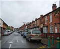
1
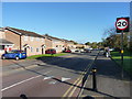
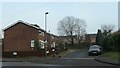
Lincoln Street, Balsall Heath
Relatively modern housing, probably 1970s era, lines either side of Lincoln Street
Image: © Richard Law
Taken: 17 Oct 2019
0.03 miles
3
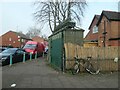
Public urinal, Court Road, Balsall Heath
Outside a former pub, and apparently still in working order. Shown on the large-scale OS map surveyed in 1938, but not on the one surveyed in 1913.
Image: © Christine Johnstone
Taken: 24 Jan 2023
0.04 miles
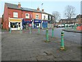
4
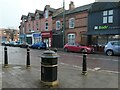
Street furniture, Edward Road, Balsall Heath
The litter bin has a Mughal influence.
Image: © Christine Johnstone
Taken: 24 Jan 2023
0.04 miles
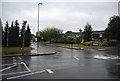
5
Minivet Drive, Balsall Heath
Off Court Road, just north of Siskin Drive. Both roads are named after birds that live in woodland - siskins in Europe and America, minivets in south and east Asia.
Image: © Christine Johnstone
Taken: 24 Jan 2023
0.05 miles
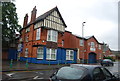
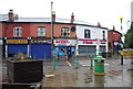
7
Shops on Edward Road, Balsall Heath
This area had not been built on in 1889. By 1913 trams were passing these shops.
Image: © Christine Johnstone
Taken: 24 Jan 2023
0.06 miles
10
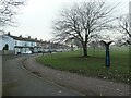
Cheddar Road and Calthorpe Park
The park was laid out in 1853, on land given by the Calthorpe family. The road and houses were built between 1889 and 1902, on the former route of the River Rea, after the river had been straightened and moved slightly west.
Image: © Christine Johnstone
Taken: 24 Jan 2023
0.08 miles