1
Shops and businesses on Ladypool Road, Balsall Heath
Image: © Richard Law
Taken: 17 Oct 2019
0.12 miles
2
Taunton Road from Stoney Lane
Image: © Peter Whatley
Taken: 12 Sep 2011
0.13 miles
3
A Boullah & Sons' Carpet Warehouse - Dennis Road frontage
Former Drill Hall for the 1 South Midland Mounted Brigade, Transport & Supply Column in 1914.
Image: © John M
Taken: 22 Jun 2014
0.14 miles
4
A Boullah & Sons' Carpet Warehouse - Taunton Road frontage
Former Drill Hall for the 1 South Midland Mounted Brigade, Transport & Supply Column in 1914.
Image: © John M
Taken: 22 Jun 2014
0.14 miles
5
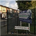
Nelson Mandela School, corner of Colville Road & Stoney Lane, Sparkbrook
Nelson Mandela School in Birmingham welcomed its first children in 1987, and was officially opened by Archbishop Desmond Tutu of Cape Town the following year. Mandela was at that time a prisoner in South Africa. He had been detained by the South African authorities in 1962 for leading resistance to the apartheid system of White supremacist rule in his country.
Mandela visited the school on the 11th October 1993. He had been released from prison in 1990 and as President of the African National Congress party was negotiating the end of apartheid with the government. The following year he was to become President of the Republic of South Africa, the country's first head of state from its Black African majority, having been elected in the country's first multiracial elections.
See Wikipedia https://en.m.wikipedia.org/wiki/Nelson_Mandela and the school site
https://www.nelsonmandelaschool.co.uk/our-school/our-history .
Image: © A J Paxton
Taken: 5 Oct 2024
0.14 miles
6
A Boullah & Sons' Carpet Warehouse - Dennis Road/Taunton Road
Former Drill Hall for the 1 South Midland Mounted Brigade, Transport & Supply Column in 1914.
Image: © John M
Taken: 22 Jun 2014
0.15 miles
7
Sparkbrook Congregational Church
Located on Ladypool Road, in the heart of 'The Balti Triangle', this church is in the middle of one of the most multicultural parts of Birmingham.
Image: © Row17
Taken: 4 Jun 2010
0.15 miles
8
Midland Bank, Ladypool Road Sub Office. 40-11-30
I worked for Midland Bank HSBC for 32 years and spent all but the last two in Birmingham Branches. I am photographing all the branches, or what's left of them, as they were when I joined Midland Bank in 1963. The branches all start with the sorting code 40-11.
This is the site of the 274 Ladypool Road sub-office on the corner of Chesterton Road. The parent branch was Sparkbrook. The sorting code was the same as Sparkbrook 40-11-30.
Image: © Roy Hughes
Taken: 17 Dec 2008
0.17 miles
9
Wilton Road
Image: © Peter Whatley
Taken: 12 Sep 2011
0.20 miles
10
Hendon Road from Wilton Road
Image: © Peter Whatley
Taken: 12 Sep 2011
0.22 miles


