IMAGES TAKEN NEAR TO
Alcester Street, BIRMINGHAM, B12 0NX

Introduction

This page details the photographs taken nearby to Alcester Street, B12 0NX by members of the Geograph project.

The Geograph project started in 2005 with the aim of publishing, organising and preserving representative images for every square kilometre of Great Britain, Ireland and the Isle of Man.

There are currently over 7.5m images from over14,400 individuals and you can help contribute to the project by visiting https://www.geograph.org.uk

Image Map


Images are licensed for reuse under creativecommons.org/licenses/by-sa/2.0
Notes
  • Clicking on the map will re-center to the selected point.
  • The higher the marker number, the further away the image location is from the centre of the postcode.

Image Listing (217 Images Found)

Images are licensed for reuse under creativecommons.org/licenses/by-sa/2.0
  • ...
Image
Details
Distance
1
27 Alcester Street, Birmingham
Possibly a former iron foundry - unlike a lot of its derelict neighbours it has since been restored and converted to flats ("Iron Works"). Pevsner refers to a coffin furniture factory of 1899-1900 in the Georgian tradition, but could that really apply to this building?
Image: © Stephen Richards Taken: 23 Jun 2015
0.02 miles
2
Adam & Eve, Digbeth
Image: © Chris Whippet Taken: 22 Jun 2014
0.03 miles
3
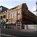
234-236 Bradford Street, Birmingham
One of numerous derelict industrial buildings hereabouts. This was the Englands shoe factory, built in 1913 by F.H. Thomason. Its decline has continued for at least another seven years Image
Image: © Stephen Richards Taken: 23 Jun 2015
0.04 miles
4
The Spotted Dog, Digbeth
Image: © Chris Whippet Taken: 22 Jun 2014
0.04 miles
5
Alcester Street, Digbeth
Seen from the junction with Green Street looking towards Deritend High Street, the Spotted Dog pub is on the right.
Image: © Stephen McKay Taken: 2 Jul 2017
0.04 miles
6
The Spotted Dog, Digbeth
The Spotted Dog is a traditional community pub with an Irish character. This suitably marked dog appears in one of the windows.
Image: © Stephen McKay Taken: 2 Jul 2017
0.04 miles
7
Bradford St
Image: © N Chadwick Taken: 12 Jun 2011
0.04 miles
8
Derelict commercial building, Bradford Street, Birmingham
Another derelict building on Bradford Street awaits its saviour. It looks early 20th century; its striped 'Moorish' arches and chequerboard banding closely resemble those on Crowngate House on Great Hampton Street, which was built in 1913 (see the Historic England listing here https://historicengland.org.uk/listing/the-list/list-entry/1075542?section=comments-and-photos ; the Bradford Street property is not a listed building).
Image: © A J Paxton Taken: 22 Mar 2022
0.04 miles
9
St Anne's Catholic Church, Digbeth
Image: © Geoff Pick Taken: 5 Nov 2010
0.07 miles
10
The Rainbow Pub
On the corner of High Street Deritend and Adderley Street in Digbeth.
Image: © Carl Baker Taken: 10 Dec 2006
0.07 miles
  • ...