1
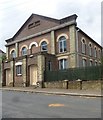
Markyate Pharmacy
A grade II listed building, 18th/19th centuries. The listing appears to include the attached housing behind, extending up Wesley Street.
Image: © Robin Webster
Taken: 7 Jan 2018
0.02 miles
2
Road sign, Markyate
Image: © Jim Osley
Taken: 1 Aug 2014
0.02 miles
3
Houses on Markyate High Street
Grade II listed, 17th century or earlier with later brick fronts. The obviously reduced opening on the side facing Albert Street is very recent, formerly there was a shop window. Presumably this was done when the shop was converted to a house.
Image: © Robin Webster
Taken: 7 Jan 2018
0.02 miles
4
The Swan, Markyate
A grade II listed building, early 17th century or earlier, with an early 18th century brick front.
Image: © Robin Webster
Taken: 7 Jan 2018
0.03 miles
5
The Swan Inn, High St, Markyate
Image: © John Lord
Taken: 3 Sep 2011
0.03 miles
6
Wesleyan Sunday School (built 1880)
Converted into a private residence.
Image: © Jim Osley
Taken: 1 Aug 2014
0.04 miles
7
Wesleyan Chapel, Markyate
Built c.1859 - more details at this http://www.bedfordshire.gov.uk/CommunityAndLiving/ArchivesAndRecordOffice/CommunityArchives/Humbershoe/WesleyanMethodismInMarkyate.aspx.
Image: © Jim Osley
Taken: 1 Aug 2014
0.04 miles
8
Markyate High Street
The Roman Watling Street, and until bypassed remarkably recently (1957), the main A5 trunk road. Even fifty years ago, pre-M1, this must have been a bit of a bottleneck.
Image: © Robin Webster
Taken: 7 Jan 2018
0.04 miles
9
Former Methodist Church, Markyate
Situated in Wesley Road, this Church is one of several Methodist Churches in the recently established West Hertfordshire & Borders Circuit, having previously been in the Harpenden Circuit. Services are held here at 10.30am every Sunday with activities taking place during the week. The original entrance to this Church was in Albert Street, before this extension was built in Wesley Road. The notice outside this church says "MARKYATE METHODIST CHURCH. Please do not park here on Sundays between 9.30 - 12.30". The postcode of this Church is AL3 8PN. Update: the final service at this church took place at 3.00pm on Sunday 1st May 2022.
Image: © David Hillas
Taken: 13 Oct 2012
0.04 miles
10
Markyate Methodist Church
Image: © John Lord
Taken: 3 Sep 2011
0.05 miles


