IMAGES TAKEN NEAR TO
Porters Wood, ST. ALBANS, AL3 6DG
Introduction
This page details the photographs taken nearby to Porters Wood, AL3 6DG by members of the Geograph project.
The Geograph project started in 2005 with the aim of publishing, organising and preserving representative images for every square kilometre of Great Britain, Ireland and the Isle of Man.

There are currently over 7.5m images from over14,400 individuals and you can help contribute to the project by visiting https://www.geograph.org.uk
Image Map
Images are licensed for reuse under creativecommons.org/licenses/by-sa/2.0
Notes
- Clicking on the map will re-center to the selected point.
- The higher the marker number, the further away the image location is from the centre of the postcode.
Image Listing (5 Images Found)
Images are licensed for reuse under creativecommons.org/licenses/by-sa/2.0
Image
Details
Distance
2

Public footpath alongside the Midland Main Line
Part of a public footpath that runs from Valley Road, through Long Spring Wood (adjacent to the Porters Wood industrial estate) and then alongside the Midland Main Line railway to where it crosses over Sandridgebury Lane. All these routes run between crop fields just north of St Albans.
Image: © Daniel Beardsmore
Taken: 31 May 2025
0.18 miles
3
Porters Wood
Part of the Valley Road Industrial Estate.
Image: © Ian Capper
Taken: 26 Jun 2013
0.19 miles
4
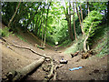
Beech Bottom Dyke
Iron Age earthwork in the middle of an urban area.
Image: © Alan Simkins
Taken: 11 May 2003
0.20 miles