IMAGES TAKEN NEAR TO
Townsend Drive, ST. ALBANS, AL3 5RN
Introduction
This page details the photographs taken nearby to Townsend Drive, AL3 5RN by members of the Geograph project.
The Geograph project started in 2005 with the aim of publishing, organising and preserving representative images for every square kilometre of Great Britain, Ireland and the Isle of Man.

There are currently over 7.5m images from over14,400 individuals and you can help contribute to the project by visiting https://www.geograph.org.uk
Image Map (Loading...)


Getting Data...Please wait
Leaflet Map data © OpenStreetMap
Images are licensed for reuse under creativecommons.org/licenses/by-sa/2.0
Notes
- Clicking on the map will re-center to the selected point.
- The higher the marker number, the further away the image location is from the centre of the postcode.
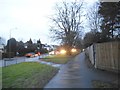
Image Listing (19 Images Found)
Images are licensed for reuse under creativecommons.org/licenses/by-sa/2.0
Image
Details
Distance
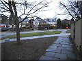
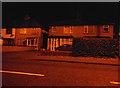
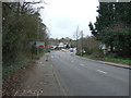
3
Batchwood View at the junction of Townsend Road
Image: © David Howard
Taken: 16 Dec 2017
0.05 miles
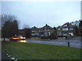
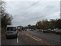
6
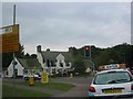
Harvester Pub on Harpenden Road crossing
The pub has been refurbished and enlarged
Image: © Jack Hill
Taken: 12 Aug 2005
0.20 miles
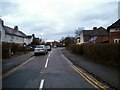
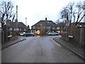
10
A1081 Harpenden Road, St.Albans
At the junction with Batchwood Drive & Beech Road near the Ancient Briton Public House
Image: © Geographer
Taken: 9 Nov 2015
0.23 miles