
IMAGES TAKEN NEAR TO
Spencer Street, ST. ALBANS, AL3 5EG
Introduction
This page details the photographs taken nearby to Spencer Street, AL3 5EG by members of the Geograph project.
The Geograph project started in 2005 with the aim of publishing, organising and preserving representative images for every square kilometre of Great Britain, Ireland and the Isle of Man.

There are currently over 7.5m images from over14,400 individuals and you can help contribute to the project by visiting https://www.geograph.org.uk
Image Map
Images are licensed for reuse under creativecommons.org/licenses/by-sa/2.0
Notes
- Clicking on the map will re-center to the selected point.
- The higher the marker number, the further away the image location is from the centre of the postcode.
Image Listing (837 Images Found)
Images are licensed for reuse under creativecommons.org/licenses/by-sa/2.0
Image
Details
Distance
1
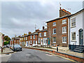
Spencer Street
Early 19th Century houses in Spencer Street. The nearest brick fronted building is nos 26 & 28 and beyond (with the small shop front) is no 30. Both buildings are grade II listed - see https://historicengland.org.uk/listing/the-list/list-entry/1103063?section=official-listing and https://historicengland.org.uk/listing/the-list/list-entry/1174513?section=official-listing respectively. Note the raised pavement.
Image: © Ian Capper
Taken: 4 Nov 2021
0.01 miles
2
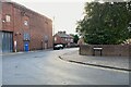
Drovers Way meets Russell Avenue, St Albans
Drovers Way is a modern street, carved from the backland west of St Peter's Street, to access car parks and hotels. Russell Avenue serves a mixture of uses.
Photo number 7624292.
Image: © Robin Stott
Taken: 16 Aug 2023
0.03 miles
5
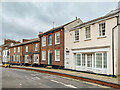
Spencer Street
Early 19th Century houses in Spencer Street. Note the raised pavement.
Image: © Ian Capper
Taken: 4 Nov 2021
0.04 miles
6
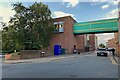
Over Drovers Way, St Albans
The bridge seems to connect the rear of Marks & Spencer to a satellite and a small car park. Drovers Way is modern, providing access to several car parks west of Market Place and St Peter's Street.
Image: © Robin Stott
Taken: 16 Aug 2023
0.04 miles
7
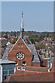
Dagnall Street Baptist Church
Dagnall Street Baptist Church (see Image) viewed from the Clock Tower across the roofs of Christopher Place.
Image: © Ian Capper
Taken: 20 Apr 2013
0.04 miles
8
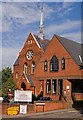
Dagnall Street Baptist Church
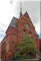
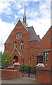
The main church building (in the background) was completed in 1885, although a congregation had been meeting on this site since 1720. The building in the foreground, the Cross Street Centre, was added in 1989.
Image: © Ian Capper
Taken: 16 Sep 2011
0.04 miles
9
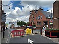
Baptist Church, St Albans
The way Dagnall Street drops away giving a glimpse of woodlands is a reminder that the Romans chose a commanding position for the town.
Image: © Robin Stott
Taken: 17 Aug 2023
0.04 miles
10
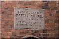
Foundation stone, Dagnall Street Baptist Church
Stone commemorating the rebuilding of the church (see Image) from 1884.
Image: © Ian Capper
Taken: 8 Jun 2019
0.04 miles