
IMAGES TAKEN NEAR TO
Fishpool Street, ST. ALBANS, AL3 4SD
Introduction
This page details the photographs taken nearby to Fishpool Street, AL3 4SD by members of the Geograph project.
The Geograph project started in 2005 with the aim of publishing, organising and preserving representative images for every square kilometre of Great Britain, Ireland and the Isle of Man.

There are currently over 7.5m images from over14,400 individuals and you can help contribute to the project by visiting https://www.geograph.org.uk
Image Map
Images are licensed for reuse under creativecommons.org/licenses/by-sa/2.0
Notes
- Clicking on the map will re-center to the selected point.
- The higher the marker number, the further away the image location is from the centre of the postcode.
Image Listing (173 Images Found)
Images are licensed for reuse under creativecommons.org/licenses/by-sa/2.0
Image
Details
Distance
1
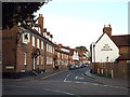
Fishpool Street, St Albans
Fishpool Street, close to the centre of St Albans.
Image: © Malc McDonald
Taken: 26 Sep 2015
0.01 miles
2
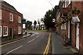
Junction of Fishpool Street and St Michael's Street
Fishpool Street and St Michael's Street were once the main road from London to the north west, following the diversion of the former Watling Street up Holywell Hill and then down to St Michaels in the 9th or 10th century. Following the building of Verulam Road by Thomas Telford in 1826, the route lost this status but still served as the road out towards Hemel Hempstead, and when road numbers were introduced in 1922 it former part of the A414 Hemel Hempstead to Chelmsford road. This role in turn ceased in the 1950s or so following the link from Batchwood Drive to Bluehouse Hill and the transfer of that number to Catherine Street, and the roads now form a quiet back route.
At the junction of Fishpool Street with St Michael's Street (off to the left in the middle distance) stand two inns, the Black Lion on the right, dating from around 1700, and the Blue Anchor on the left, dating from the late 18th century. Both are grade II listed - see www.historicengland.org.uk/listing/the-list/list-entry/1172914 and www.historicengland.org.uk/listing/the-list/list-entry/1103115 respectively.
In the background is the grade II listed Kingsbury Mill - for listing particulars see www.historicengland.org.uk/listing/the-list/list-entry/1103081.
Image: © Ian Capper
Taken: 3 May 2012
0.01 miles
3
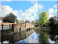
Bridge & Disused Ford, St Michael's Street St Albans
Image: © Roy Hughes
Taken: 21 Apr 2012
0.02 miles
4
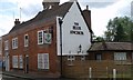
Former Blue Anchor, St Albans
One of several former pubs in Fishpool Street. This one still displays its name and sign.
Image: © David960
Taken: 21 May 2017
0.02 miles
5
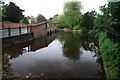
Former Ford at St Michaels
This ford on the River Ver is found at St Michaels near the Cathedral at St Albans. The ford is blocked at both ends.
Image: © John Walton
Taken: 12 May 2013
0.02 miles
6
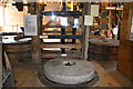
Kingsbury Mill, St Albans
The upstairs of the mill is a museum while the lower floor is a waffle restaurant. This shows three stones and the crown wheel.
Image: © Chris Allen
Taken: 11 Mar 2007
0.03 miles
7
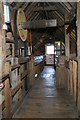
Kingsbury Mill, St Albans
The upper floors are a museum while the ground floor is a waffle restaurant. This shows the bin floor and sack hoist. I haven't got any pictures of the ground floor as it was full of diners and tables.
Image: © Chris Allen
Taken: 11 Mar 2007
0.03 miles
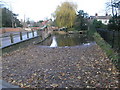
9
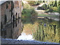
St Michael?s Bridge over the River Ver, St Albans
Image: © Peter S
Taken: 1 Oct 2011
0.03 miles
10
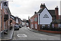
Fishpool Street
A long-established street with some pubs, and a former pub on the left.
Image: © Bill Boaden
Taken: 29 Feb 2020
0.03 miles