IMAGES TAKEN NEAR TO
Cassius Drive, ST. ALBANS, AL3 4GD
Introduction
This page details the photographs taken nearby to Cassius Drive, AL3 4GD by members of the Geograph project.
The Geograph project started in 2005 with the aim of publishing, organising and preserving representative images for every square kilometre of Great Britain, Ireland and the Isle of Man.

There are currently over 7.5m images from over14,400 individuals and you can help contribute to the project by visiting https://www.geograph.org.uk
Image Map
Images are licensed for reuse under creativecommons.org/licenses/by-sa/2.0
Notes
- Clicking on the map will re-center to the selected point.
- The higher the marker number, the further away the image location is from the centre of the postcode.
Image Listing (26 Images Found)
Images are licensed for reuse under creativecommons.org/licenses/by-sa/2.0
Image
Details
Distance
1
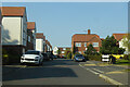
Mortimer Crescent, King Harry Park, St Albans
A rather new development.
Image: © Robin Webster
Taken: 2 May 2021
0.07 miles
2
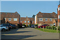
Cassius Drive, King Harry Park, St Albans
A rather new development.
Image: © Robin Webster
Taken: 2 May 2021
0.09 miles
3
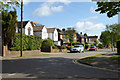
Houses on Abbey Avenue
St Stephens, a suburb of St Albans.
Image: © Robin Webster
Taken: 14 May 2017
0.11 miles
4
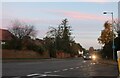
King Harry Lane, St Albans
At the end of Abbey Avenue
Image: © David Howard
Taken: 13 Nov 2022
0.12 miles
6
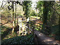
Footbridge over the vallum
The wooden bridge gives easy pedestrian and cycle access over what would otherwise be a significant obstacle Image
Image: © Stephen Craven
Taken: 8 Mar 2014
0.13 miles
7
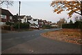
Abbey Avenue at the end of St Stephens Avenue, St Albans
Image: © David Howard
Taken: 13 Nov 2022
0.13 miles
8
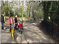
Segregated cycle path - top
The western (top) end of a segregated cycle/pedestrian path, approximately 320m long, between the vallum and wall of the Roman city of Verulamium. See Image for the other end.
Image: © Stephen Craven
Taken: 8 Mar 2014
0.14 miles
9
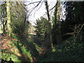
Roman vallum at Verulamium
It is not obvious that this wooded depression is in fact the defensive ditch (vallum) of a Roman town, rather than a natural stream bed. But according to an interpretation board on site, it is.
Image: © Stephen Craven
Taken: 8 Mar 2014
0.15 miles