
IMAGES TAKEN NEAR TO
Ulverston Close, ST. ALBANS, AL1 5DW
Introduction
This page details the photographs taken nearby to Ulverston Close, AL1 5DW by members of the Geograph project.
The Geograph project started in 2005 with the aim of publishing, organising and preserving representative images for every square kilometre of Great Britain, Ireland and the Isle of Man.

There are currently over 7.5m images from over14,400 individuals and you can help contribute to the project by visiting https://www.geograph.org.uk
Image Map
Images are licensed for reuse under creativecommons.org/licenses/by-sa/2.0
Notes
- Clicking on the map will re-center to the selected point.
- The higher the marker number, the further away the image location is from the centre of the postcode.
Image Listing (169 Images Found)
Images are licensed for reuse under creativecommons.org/licenses/by-sa/2.0
Image
Details
Distance
1
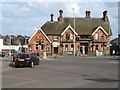
St Albans: The Crown
Formerly The Crown Hotel the pub occupies a prominent location on Hatfield Road. It probably dates from the 1890s.
The 1901 Census return gives the following occupiers:
Mary Clarke, a licenced victualler, aged 54, a widow with her children Emily, Margery, William and Bernard, aged 28, 20, 17 and 13.
In the 1911 Census it's the identical family, described as Mary Clarke, a licenced victualler, aged 65, a widow with her children Emily, Margery, William and Bernard, aged 38, 30, 27 and 24. By this time William was the manager of the public house while the other three were assisting in the business, all of the four children being single.
Image: © Nigel Cox
Taken: 24 Jun 2010
0.08 miles
2
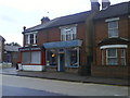
Hatfield Road
Shops in Hatfield Road St Albans
Image: © Gary Fellows
Taken: 16 Oct 2007
0.08 miles
3
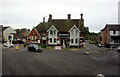
The Crown public house
On Camp Road, St Albans.
Image: © Ian S
Taken: 18 Jun 2022
0.08 miles
4
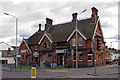
The Crown
Late Victorian pub at the junction of Hatfield Road with Camp Road. Locally listed.
Image: © Ian Capper
Taken: 4 Oct 2011
0.09 miles
5
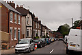
Albion Road
Road largely developed in the 1880s on the site of a former nursery, Ninedells.
Image: © Ian Capper
Taken: 26 Jun 2012
0.09 miles
6
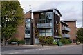
De Novo Place
Built in around 2000 on the site of the former Adult School. The site behind it, also now flats, was formerly the site of the Gaumont Cinema, opened in 1922 as the Grand Cinema Palace. From 1950 it was named the Gaumont, but closed in 1973, serving as a bingo club until 1973.
Image: © Ian Capper
Taken: 4 Oct 2011
0.09 miles
7
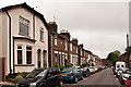
Albion Road
Road largely developed in the 1880s on the site of a former nursery, Ninedells.
Image: © Ian Capper
Taken: 26 Jun 2012
0.09 miles
8
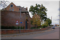
Victoria Square
Housed in the former St Albans Prison, which had been built in 1867 and served in that tole until the 1920s. For many years it was then used as a council depot, but has now beed redeveloped for offices, including the local registry office in the gatehouse. The entrance (see Image) was made famous by its use in the title sequence of the 1970s BBC comedy series "Porridge".
Seen here are the walls facing Grimston Road and Shirley Road. They are locally listed.
Image: © Ian Capper
Taken: 4 Oct 2011
0.11 miles
9
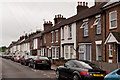
Cavendish Road
Road largely developed in the 1880s on the site of a former nursery, Ninedells.
Image: © Ian Capper
Taken: 26 Jun 2012
0.12 miles
