IMAGES TAKEN NEAR TO
Savoy Mews, Watford Road, ST. ALBANS, AL1 2AN
Introduction
This page details the photographs taken nearby to Savoy Mews, Watford Road, AL1 2AN by members of the Geograph project.
The Geograph project started in 2005 with the aim of publishing, organising and preserving representative images for every square kilometre of Great Britain, Ireland and the Isle of Man.

There are currently over 7.5m images from over14,400 individuals and you can help contribute to the project by visiting https://www.geograph.org.uk
Image Map
Images are licensed for reuse under creativecommons.org/licenses/by-sa/2.0
Notes
- Clicking on the map will re-center to the selected point.
- The higher the marker number, the further away the image location is from the centre of the postcode.
Image Listing (35 Images Found)
Images are licensed for reuse under creativecommons.org/licenses/by-sa/2.0
Image
Details
Distance
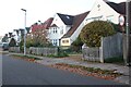
3
St Albans : Watling Street A5183
Looking along Watling Street.
Image: © Lewis Clarke
Taken: 27 Apr 2019
0.15 miles
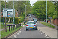
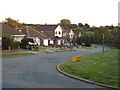
4
A5183 Watling Street, St Albans
On the course of the Roman road.
Image: © Robin Webster
Taken: 2 May 2021
0.16 miles
5
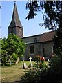
St Stephen's Church St Albans
This church has sufficient land for car parking which is a boon as the road outside is always busy.
Image: © Jack Hill
Taken: 15 Jul 2005
0.18 miles
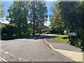
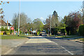
9
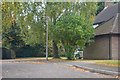
St Albans : Watling Street
Looking to a small road off of the A5183.
Image: © Lewis Clarke
Taken: 4 Oct 2018
0.18 miles
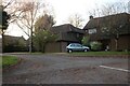
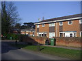
10
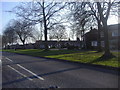
Houses on Tithe Barn Close from Watling Street
Image: © David Howard
Taken: 4 Mar 2011
0.20 miles